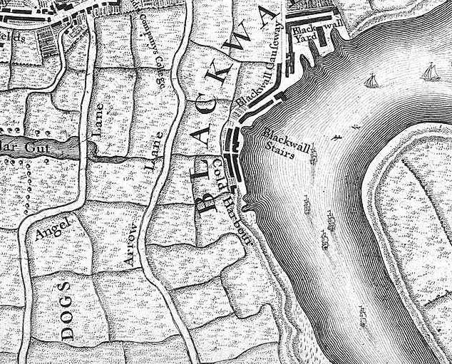
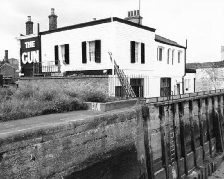
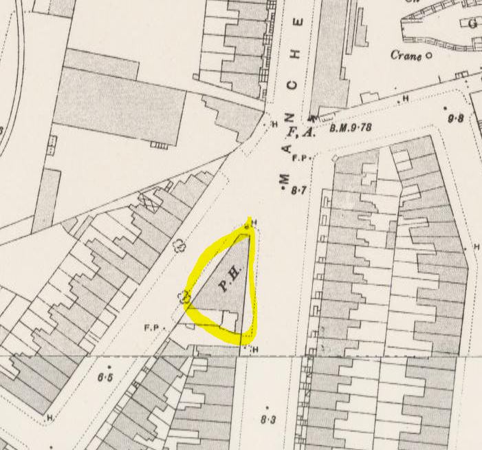
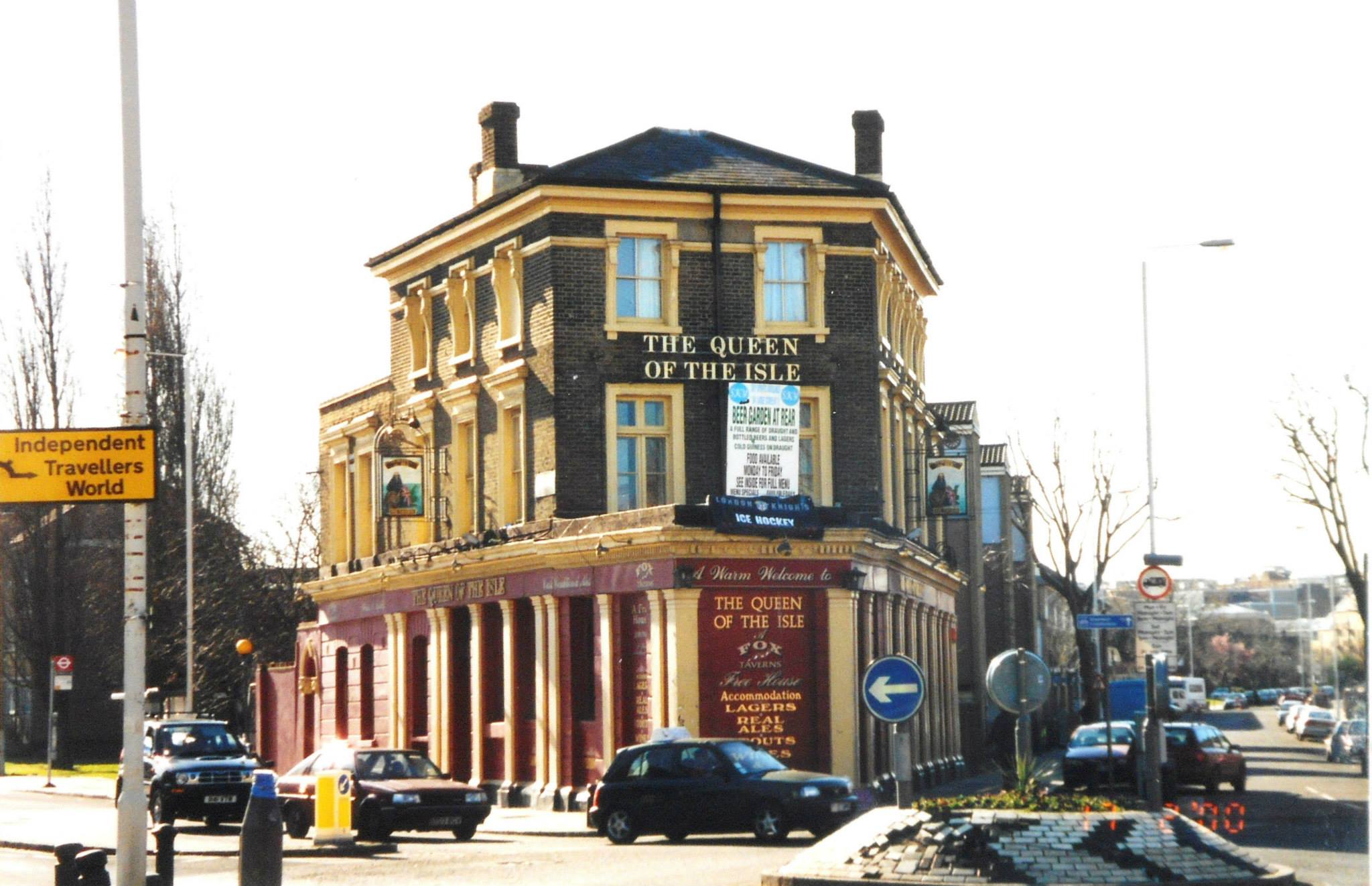
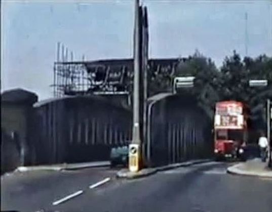
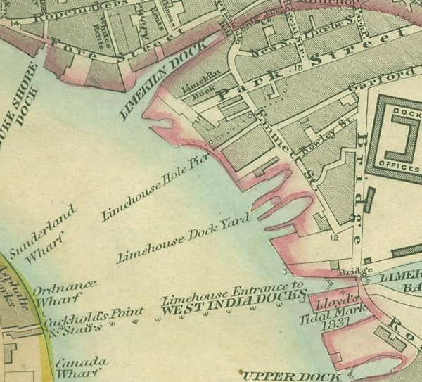
It is well known that many Island streets and buildings are (or were) named after ships or barques or other types of sea-going vessel, or have a nautical theme. It is surprising just how many:
Akbar House, Alastor House, Arethusa House, Argyle House, Barque Street, Bowsprit Point, Brassey House, Brig Street, Capstan Square, Carvel House, Castalia Square, Clipper House, Conway House, Exmouth House, Finwhale House, Fishing Smack Public House, Galleon House, Great Eastern Public House, Halyard House, Harbinger School, Hesperus Crescent, Kedge House, Kelson House, Killoran House, Knighthead Point, Launch Street, Lingard House, Llandovery House, Macquarie Way, Mast House Terrace, Michigan House, Midship Point, Montcalm House, Montfort House, Montrose House, Pinnace House, Quarterdeck, Rawalpindi House, Rodney House, Schooner Street/House/Close, Ship Public House, Ship Street, Spinnaker House, Tamar House, Thermopylae Gate, Topmast Point, Triton House, Warspite House.
Not to mention those names to do with sailors and sea voyagers (Nelson, Chichester, Cabot, etc) or with shipbuilding (Dunbar, Yarrow, Samuda, Mast House, etc).
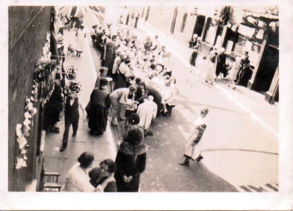
I thought it time to catalogue everything as much as I could. I expected this article to be a dry statement of facts – and admittedly that’s what it is in some places – but research also revealed dramatic and tragic stories. The sea was evidentally a hard place, and although these stories have an only tangential connection with the Island, they are worth retelling.
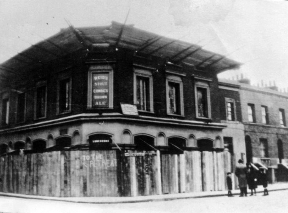
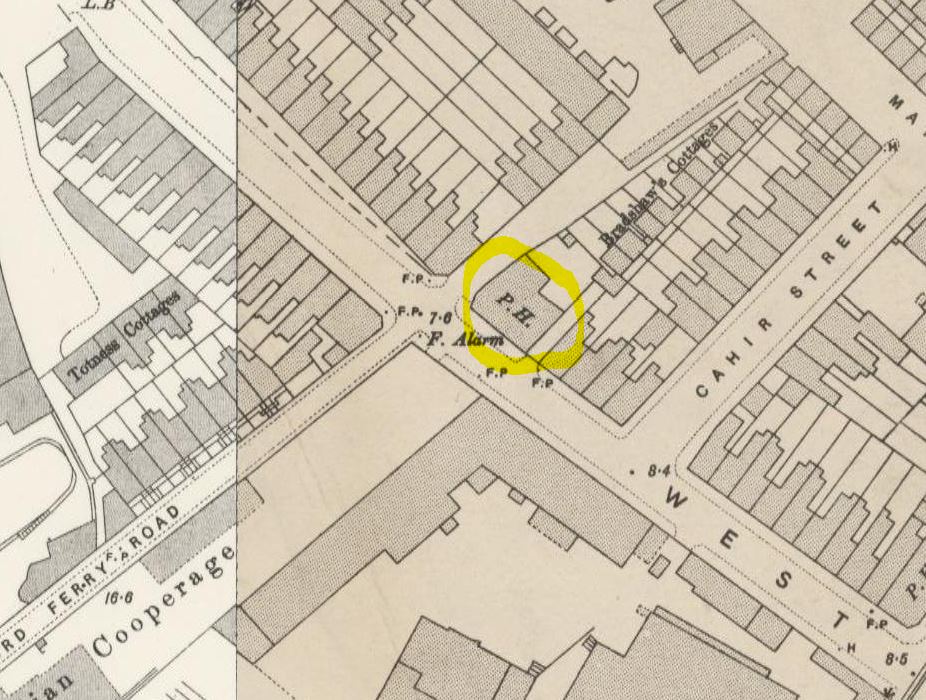
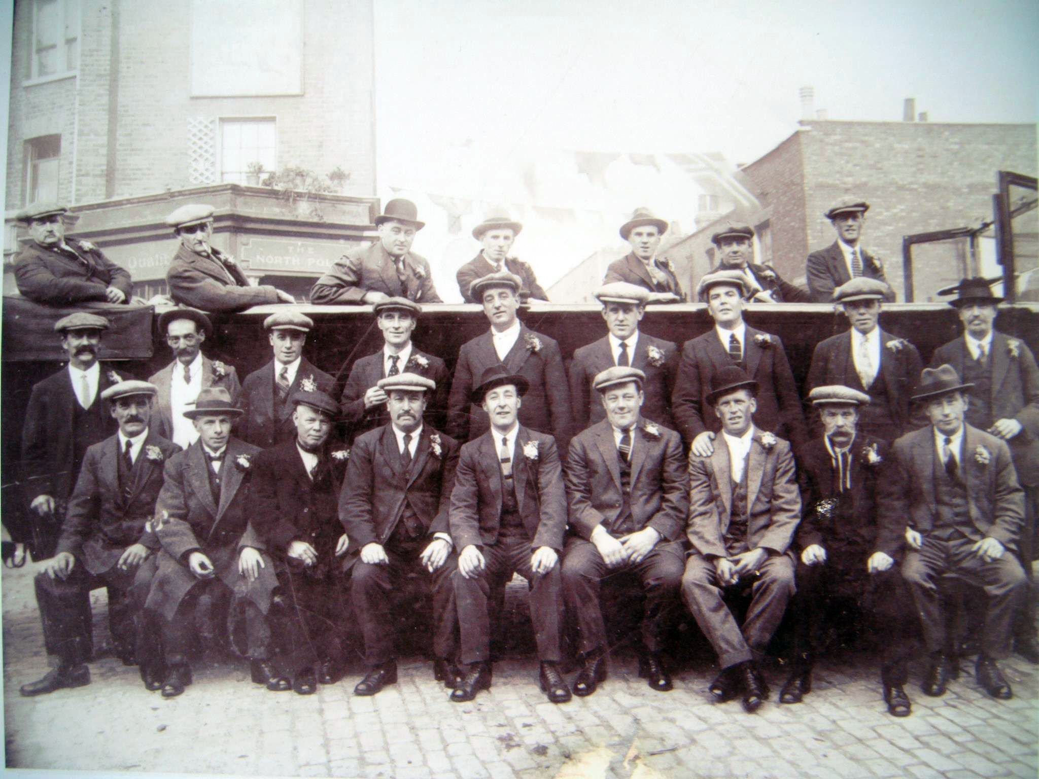
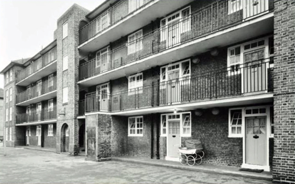
Akbar House, Cahir Street
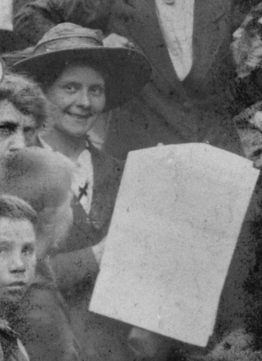
See section on Arethusa House, below, for old photo.
The Akbar was a Protestant reformatory ship for boys who had been in trouble with the law (basically, a floating borstal). It was moored in the Mersey from the latter part of the
nineteenth century, along with other educational ships:
- Clarence, a reformatory ship for Catholic boys
- Training Ship Indefatigable, for poor and orphaned boys whose fathers were seamen
- HMS Conway, for training boys from better off backgrounds to be officers in the Merchant Navy
Akbar

Conway, Akbar and Indefatigable
Life was tough on the reformatory school ships, and corporal punishment routine. In 1994, the BBC interviewed George Kirby, born in Liverpool in 1922, who had been an inmate on the boys’ training ship Cornwall, moored in the Thames. The video includes some shots from a newsreel item about the training ship Arethusa, filmed in 1931, not long before George’s ‘education’.
The training ships on the Mersey closed after World War II, due to the drop in demand in Britain for merchant seamen.
Alastor House, Strattondale Street

The barque ‘Alastor’ was built in Sunderland in 1875. Sold to Norwegian owners in 1895 she traded under the Finnish flag from 1928 until June 1939, when she carried timber from Sweden to Millwall Docks, her last commercial voyage. After that she was laid up in the Blackwater Estuary in Essex and then used for military purposes for the duration of the war.
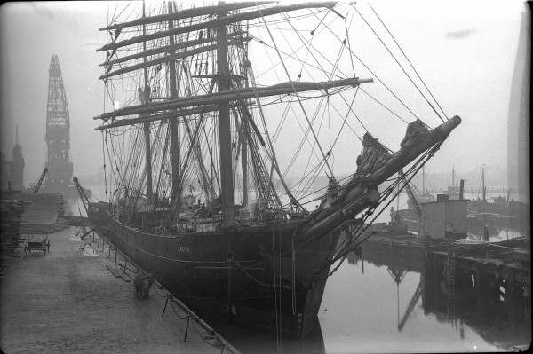
The original caption for this photo describes it as the Alastor in either in Millwall Docks or Birkenhead. Doesn’t look like Millwall Docks to me.

Barque Alastor
Post-war she was renamed Bounty and used as a restuarant at Ramsgate (not a commercial success). There were plans to tow her up the Thames to feature as an attraction at the Festival of Britain, but these plans came to nothing and she was broken up at Grays c1952.

Alastor as ‘Bounty’, Ramsgate
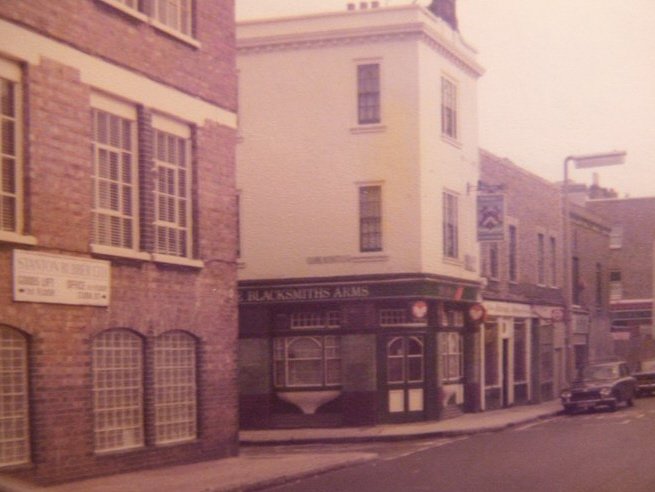
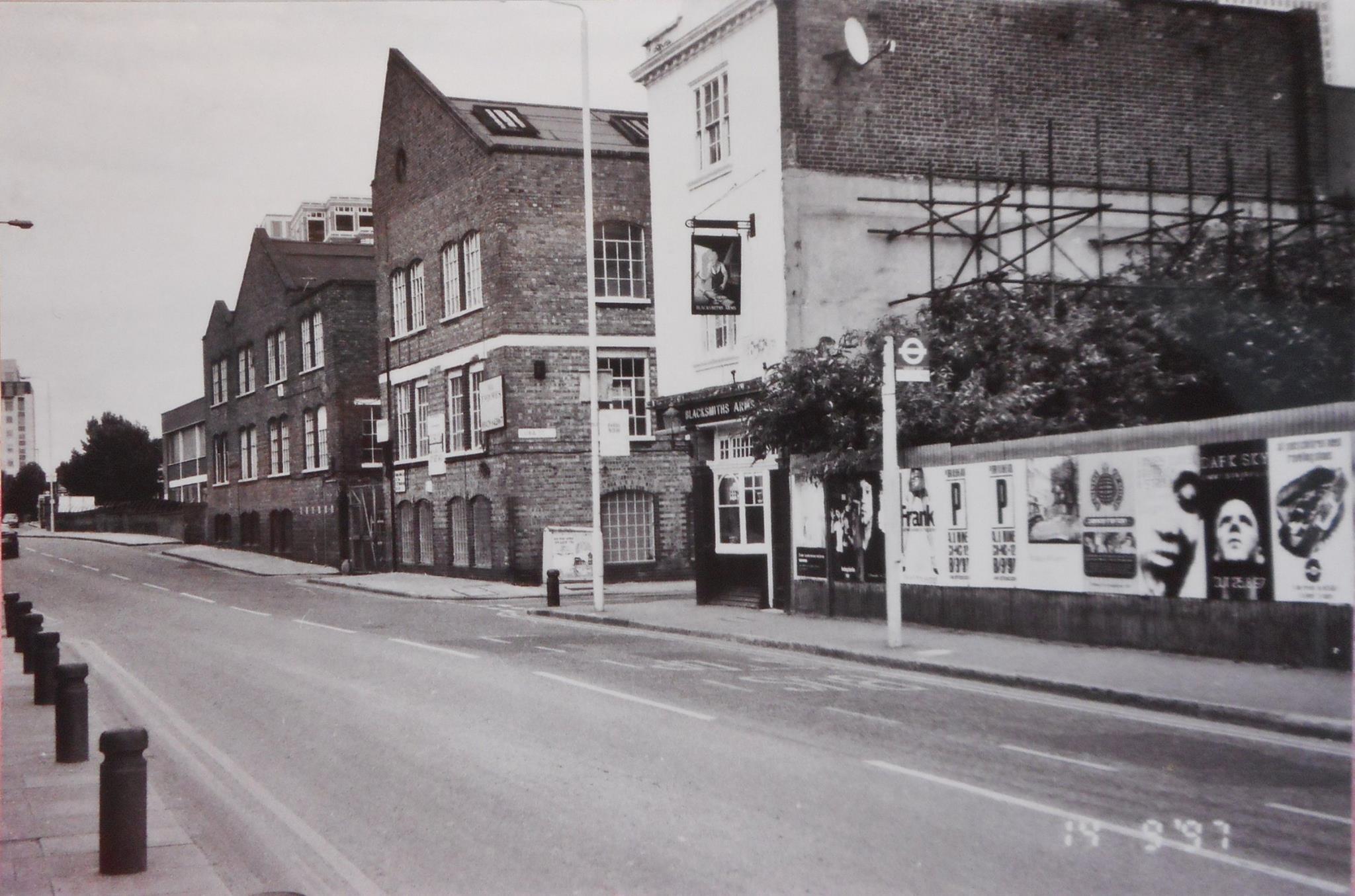
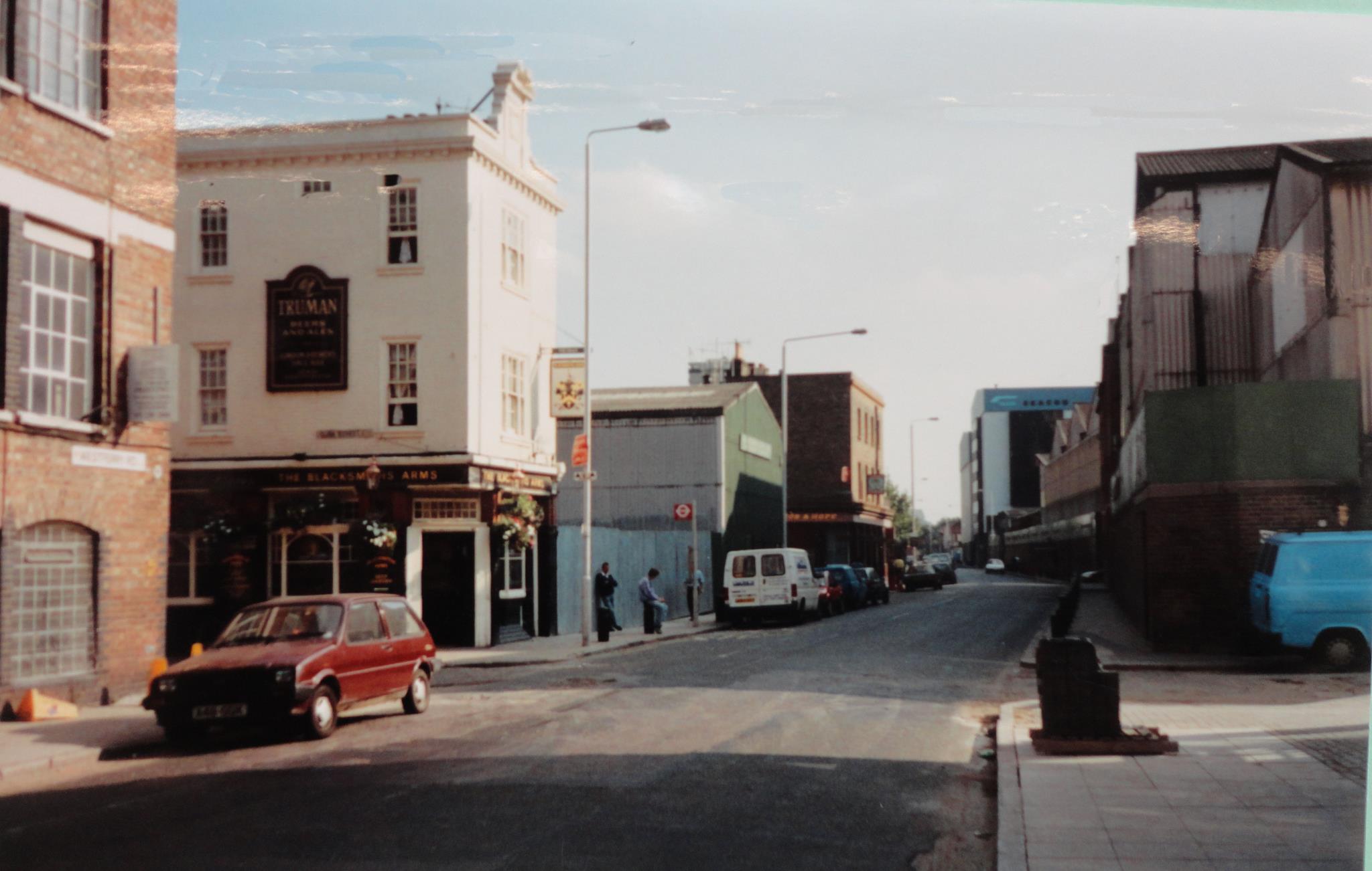
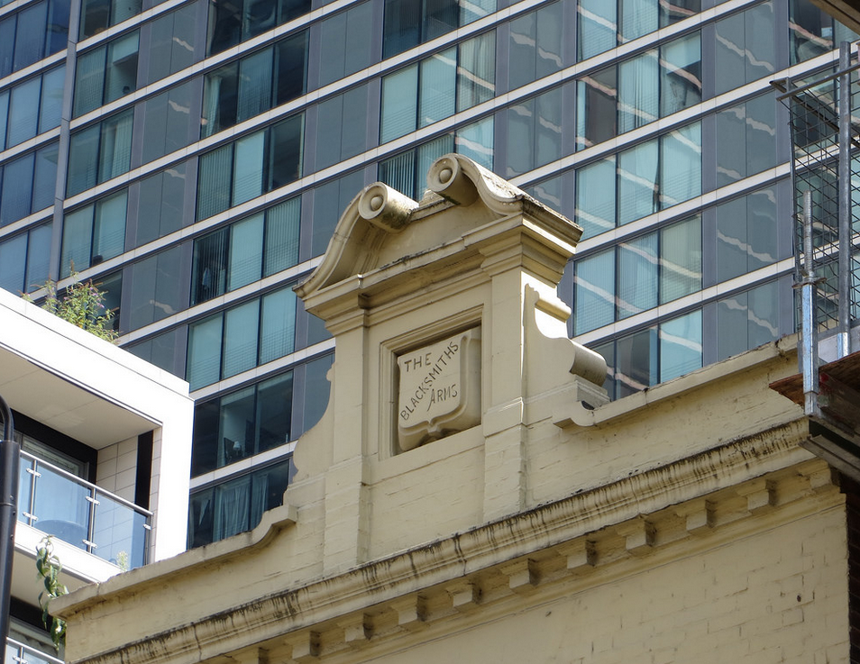
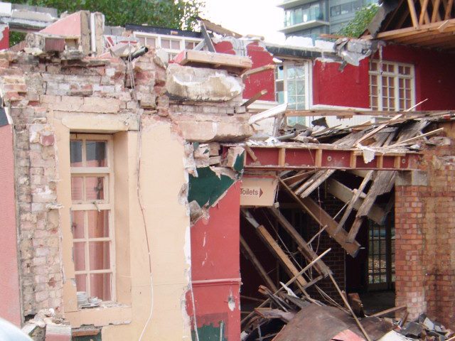
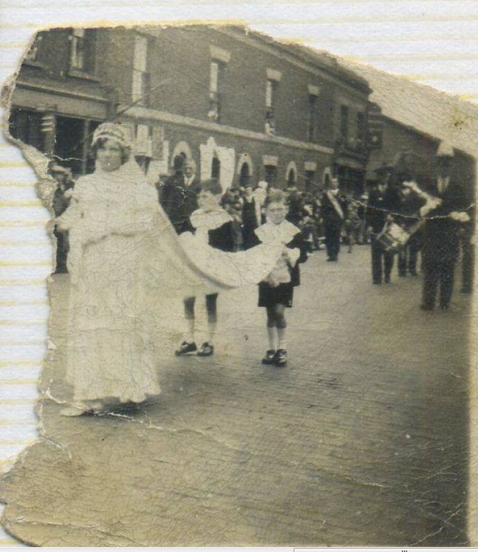
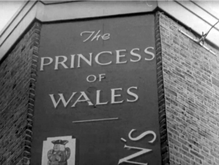
Arethusa House, Cahir Street

Arethusa House (L), Akbar House (R)
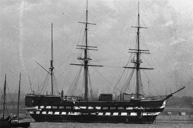
HMS Arethusa was a 50-gun frigate, launched in 1849 from the Pembroke Dockyard and served in the Crimean War. In 1861 she was converted to a steam screw frigate.
Decommissioned in 1874, Arethusa became a school and training ship at Greenhithe on the Thames, providing refuge and teaching maritime skills to destitute young boys who had been sleeping rough on the streets of London, training them for a career in the Royal Navy or Merchant Navy. She was broken up in 1934 (but replaced by another ship which was renamed Arethusa).
See the section on Alastor House, above, for film of the Arethusa.

Arethusa, c1900

That ships were dangerous places is revealed by this gravestone at the churchyard of St. Philip, Penn Fields, Wolverhampton. I read elsewhere that the boy’s death was the result of an accident, but have no further details. The Bible quote (from Isaiah 43:2) does infer that he drowned.

Argyle House, Marshfield Street

Argyle House, like other blocks in the neighbourhood, is named after a merchant ship which was a regular visitor to Millwall Docks. However, an internet search reveals two ships named SS Argyle, one of which was lost off Cuba in 1946 and the other deliberately scuttled in Scapa Flow in 1914 in order to block a sea passage to deny access to enemy ships. It does seem odd to name a block of flats after a ship which was lost at sea, so I’m going for the scuttled SS Argyle.

SS Argyle
Built in 1872 by Gilbert & Cooper, Hull, the SS Argyle was requisitioned by the Admiralty in 1914. The vessel was scuttled in Skerry Sound on the 17th September 1914.
During World War I strong defences were put in place throughout Scapa Flow to protect the British ships against attack. Anti-submarine netting was suspended across some of the larger channels into the Flow. Blockships were deliberately sunk in the smaller channels to further prevent the possibility of the Germans gaining access into Scapa Flow.
– http://www.scapaflowwrecks.com
If you’re into diving, you can always go visit the wreck: http://www.scapaflowwrecks.com/wrecks/blockships/ss-argyle.php

WWI blockships in Scapa Flow
Barque Street

Revealing yet again my ignorance of maritime matters, I had to look up ‘barque’ in an online dictionary to find out what that means. It is:
…a sailing ship, typically with three masts, in which the foremast and mainmast are square-rigged and the mizzenmast is rigged fore and aft.
Mmm, I think I am a little the wiser.
Bowsprit Point, Barkantine Estate

A bowsprit is:
..a spar running out from a ship’s bow, to which the forestays are fastened
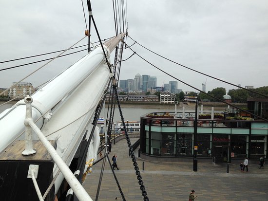
The bowsprit of the Cutty Sark
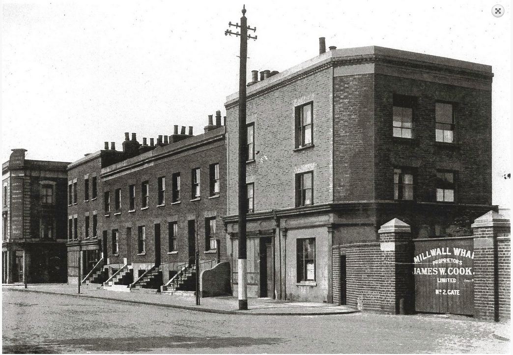
Brassey House, Cahir Street

The only entry in this article named for a person and not a ship. I made the exception because all the other buildings on the estate in Cahir Street are named after (training) ships, and it was Lord Brassey who played a key part in their establishment (the ships, that is).
In 1880 Brassey’s book The British Navy was published. In 1886, he started The Naval Annual (generally referred to as Brassey’s Naval Annual). In the year 1890 it was felt by Brassey and a few others that it was time some effort was made to better train apprentices, because at the time apprentices were being used merely as drudges to do all the dirty work aboard ship, and were not receiving in instruction in navigation and other skills.
Known as the ‘Brassey Scheme’, vessels were acquired by Brassey and his business partners. Apart from practical seamanship, training instructions were provided on board the vessels to teach the cadets arithmetic, algebra, geometry, navigation and nautical astronomy. The first vessels acquired for the new scheme were the iron ships Harbinger and Hesperus.
Brig Street

A brig is:
…a two-masted square-rigged ship, typically having an additional lower fore-and-aft sail on the gaff and a boom to the mainmast.
A brig
Capstan Square

A capstan is:
… a broad revolving cylinder with a vertical axis used for winding a rope or cable, powered by a motor or pushed round by levers.
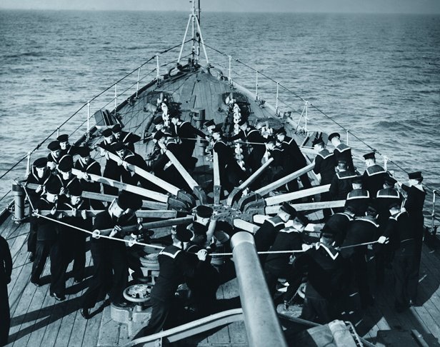
Royal Navy cadets pushing a capstan
Carvel House, Manchester Road
Carvel built or carvel planking:
… is a method of boat building where hull planks are fastened edge to edge, gaining support from the frame and forming a smooth surface.
In contrast with clinker built hulls, where planked edges overlap, carvel construction gives a stronger hull, capable of taking a variety of full-rigged sail plans, albeit one of greater weight. In addition, it enables greater length and breadth of hull and superior sail rigs because of its strong framing, and is one of the critical developments that led to the preeminence of Western European seapower during the Age of Sail and beyond.

Clinker and carvel comparison
Castalia Square

Castalia Square in the 1970s
The Castalia was an unusual twin-hulled paddle steamer built in 1874 by the Thames Ironwork and Shipbuilding Company for the English Channel Steamship Company. It was designed by the worryingly-named Captain Dicey, who thought that the twin hull would make the vessel more stable, thus leading to less seasickness among the passengers (there was room for 700).

Castalia

Aboard the Castalia
Not a success – in large part because it was simply too slow – the ship was advertised for sale in 1881 on the instruction of the mortgagees, Messrs Bailey & Ridley. Two years later it was sold to the Metropolitan Asylums Board who converted it into a hospital ship for contagious diseases (primarily smallpox) with room for 150 female patients (male patients were housed in another ship, the Atlas, moored adjacent to the Castalia). Its engine and paddles were removed, and hospital blocks were built on the by-then bare deck. In 1885, it was reported that a child born on board the ship had been named Castalia.

After conversion to hospital ship, off Dartford.

On 9 December 1898, the SS Barrowmore was in collision with the Castalia. Some of the patients jumped overboard. Castalia had to be dry docked for repairs at the yard of Blackwall firm, John Stewart. In December 1904, she was sold by auction at the Bull Hotel, Dartford, Kent, for breaking.

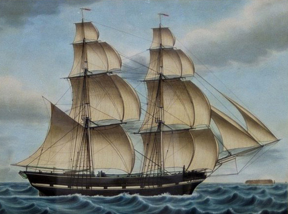
Clipper House, Manchester Road

A clipper is:
…a fast sailing ship, especially one of 19th-century design with concave bows and raked masts.

The clipper, Cutty Sark in 1869
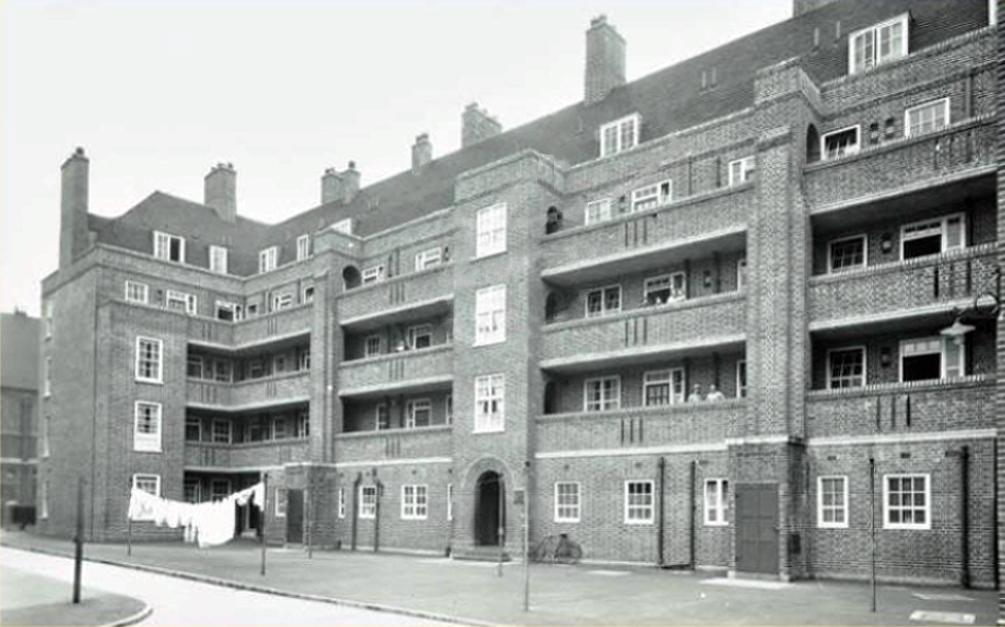
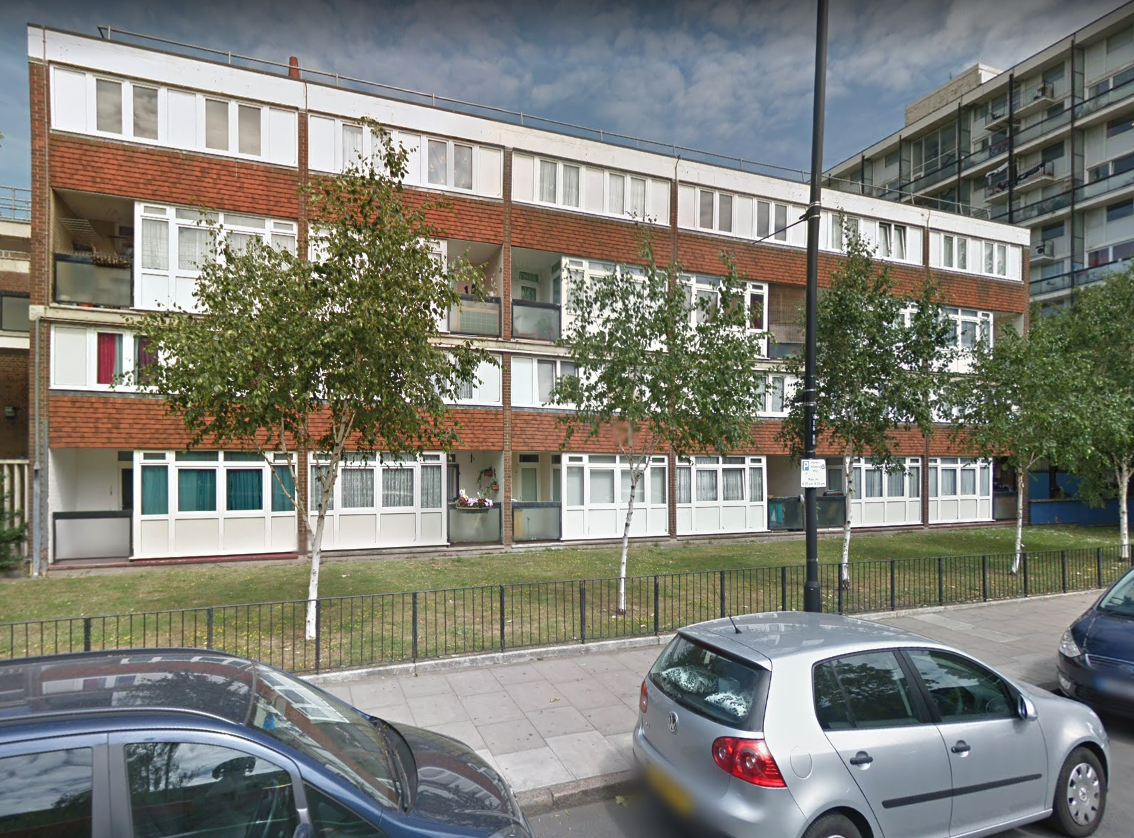
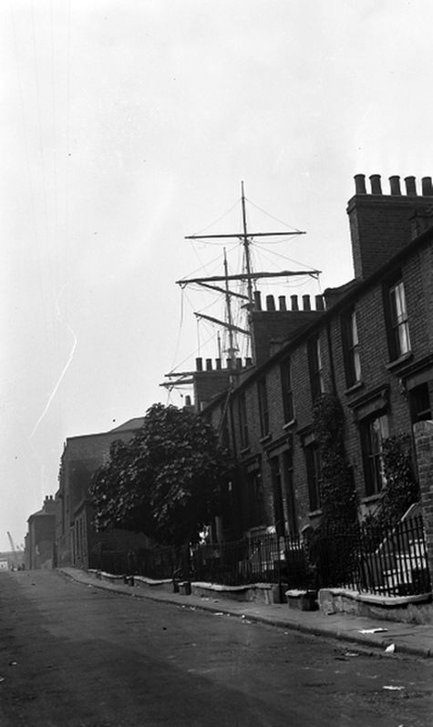
Conway House, Cahir Street

Conway House (nearmost, bottom left) immediately after WWII.
HMS Conway was a naval training school or “school ship”, founded in 1859 and housed for most of her life aboard a 19th-century wooden ship of the line. The ship was originally stationed on the Mersey near Liverpool, then moved to the Menai Strait during World War II.
Launched in June 1839, she was entirely built from West African hardwoods and copper fastened, with copper sheathing anti-fouling to her under parts. She had survived the Baltic Blockade during the Crimean War, later protecting British possessions in the Caribbean and ‘showing the flag’ along the eastern seaboard of North America 50 years after the British surrender at Yorktown.

HMS Conway

HMS Conway

c1950
While being towed back to Birkenhead for a refit in 1953, she ran aground and was wrecked, and later burned.

“What was it you said, sir, Port is right, and Starboard is left?”
Exmouth House, Cahir Street

There were two training ships named Exmouth: No 1 from 1876 to 1905 and No. 2 from 1905 to 1939. The first ship was loaned to The Metropolitan Asylums Board by the Admiralty and had been named after Viscount Exmouth.
The Exmouth was laid down in 1840 and was a screw ship of 91 guns. She was commissioned in 1855 and served with the Baltic Fleet. She was crewed by some 500 boys. The Exmouth was replaced by another vessel named Exmouth in 1905 and remained anchored off Grays until 1939. The second Exmouth remained at Grays until the start of World War II when she was used for other purposes.

TS Exmouth

TS Exmouth

TS Exmouth
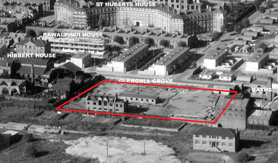
Finwhale House, Glengall Grove
HMS Finwhale (S05) was the fifth Porpoise class submarine of the Royal Navy. She was launched on 21 July 1959 and first commissioned on 19 August 1960. During her first commission she went further under the ice than any other submarine at the time. She was recommissioned on 27 January 1964. In March 1965 on her second Arctic patrol she further eclipsed her first ice patrol, penetrating 95 miles into the ice. She was used as a harbour training vessel between 1979 and 1987. She left under tow for scrapping in Spain on 28 March 1988.
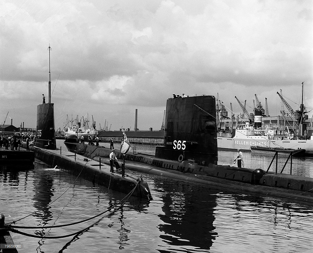
HMS Finwhale (L), HMS Alcide (R) – in West India Docks

HMS Finwhale in West India Docks

HMS Alcide (L), HMS Finwhale (R) – in West India Docks

HMS Finwhale in a warmer looking climate.
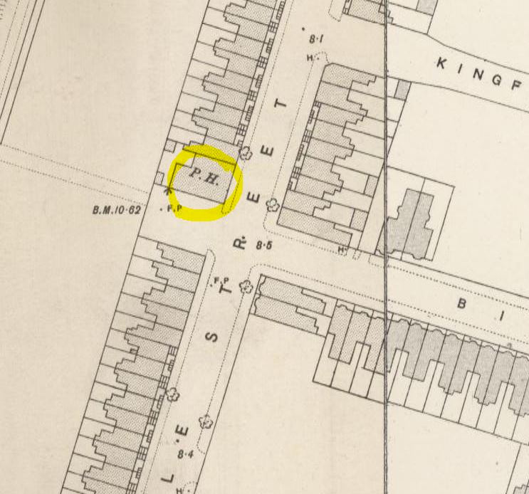
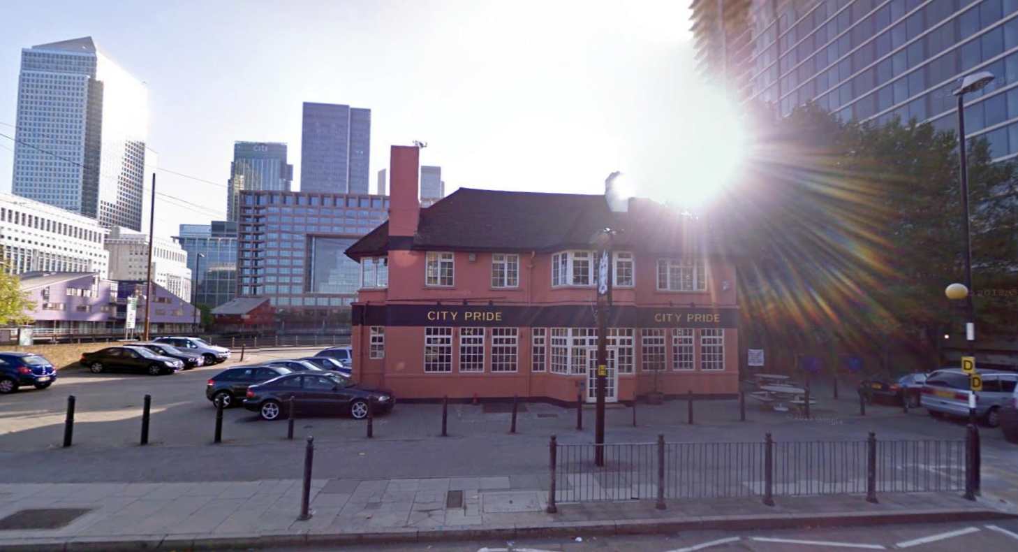
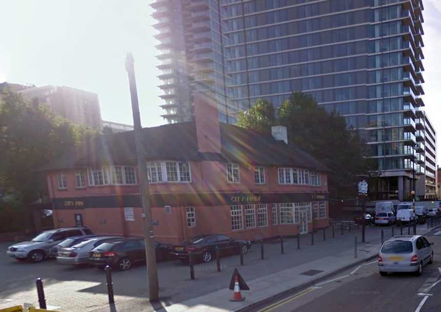
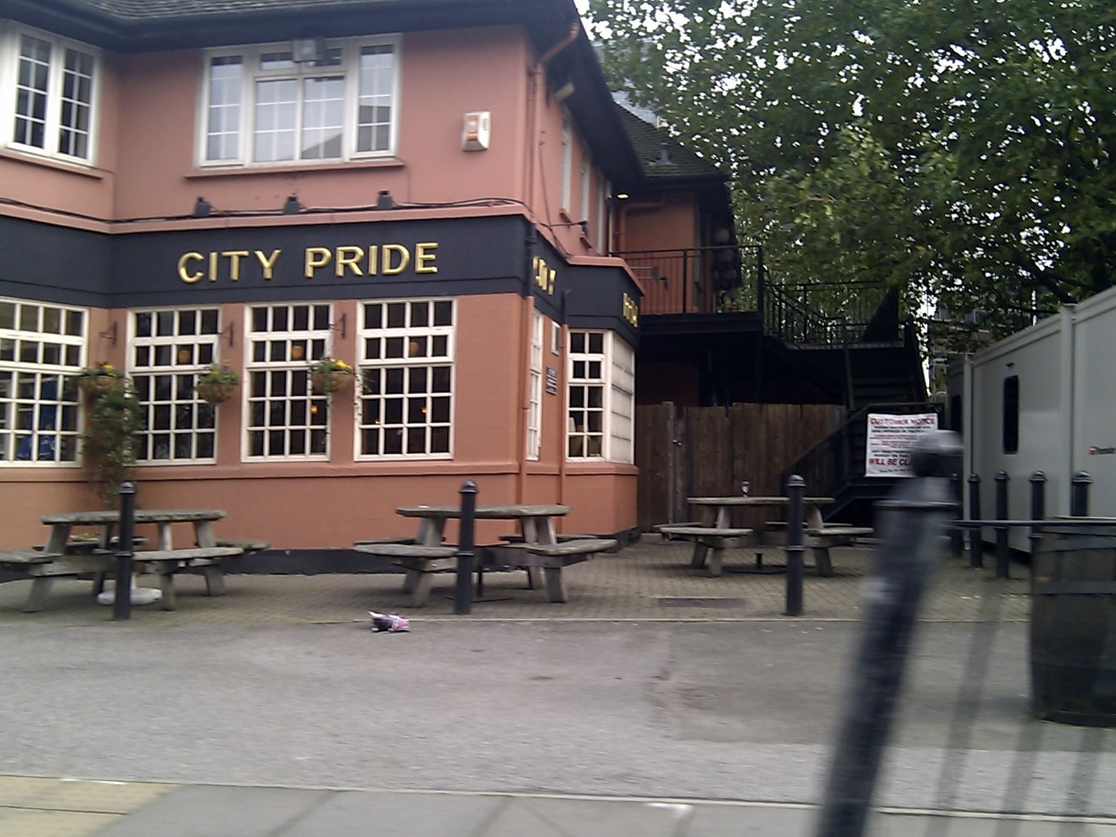
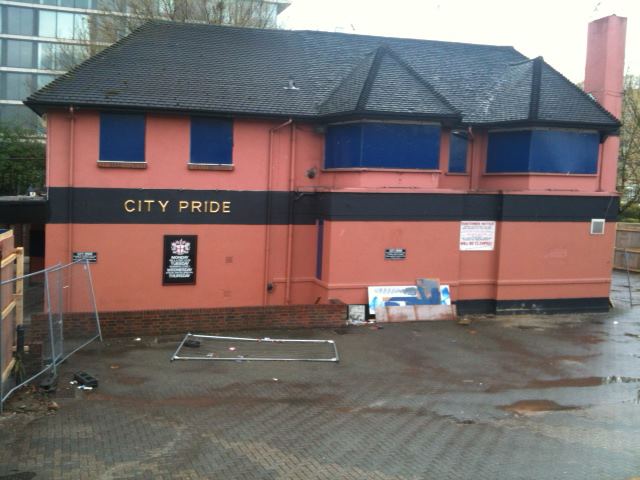
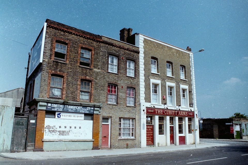
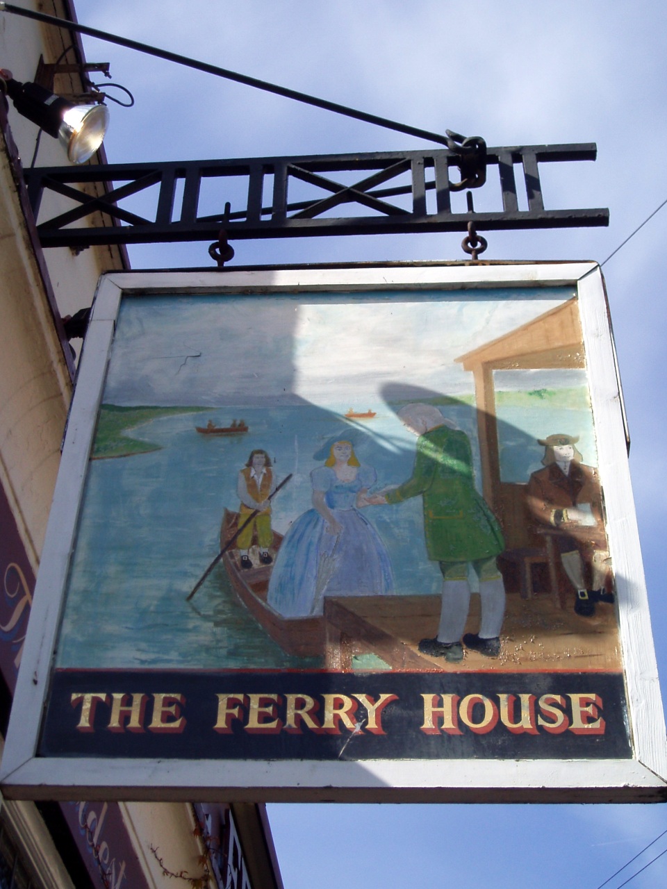
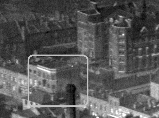
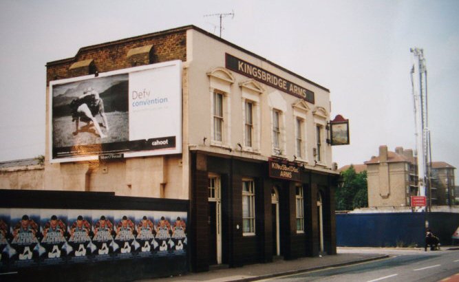
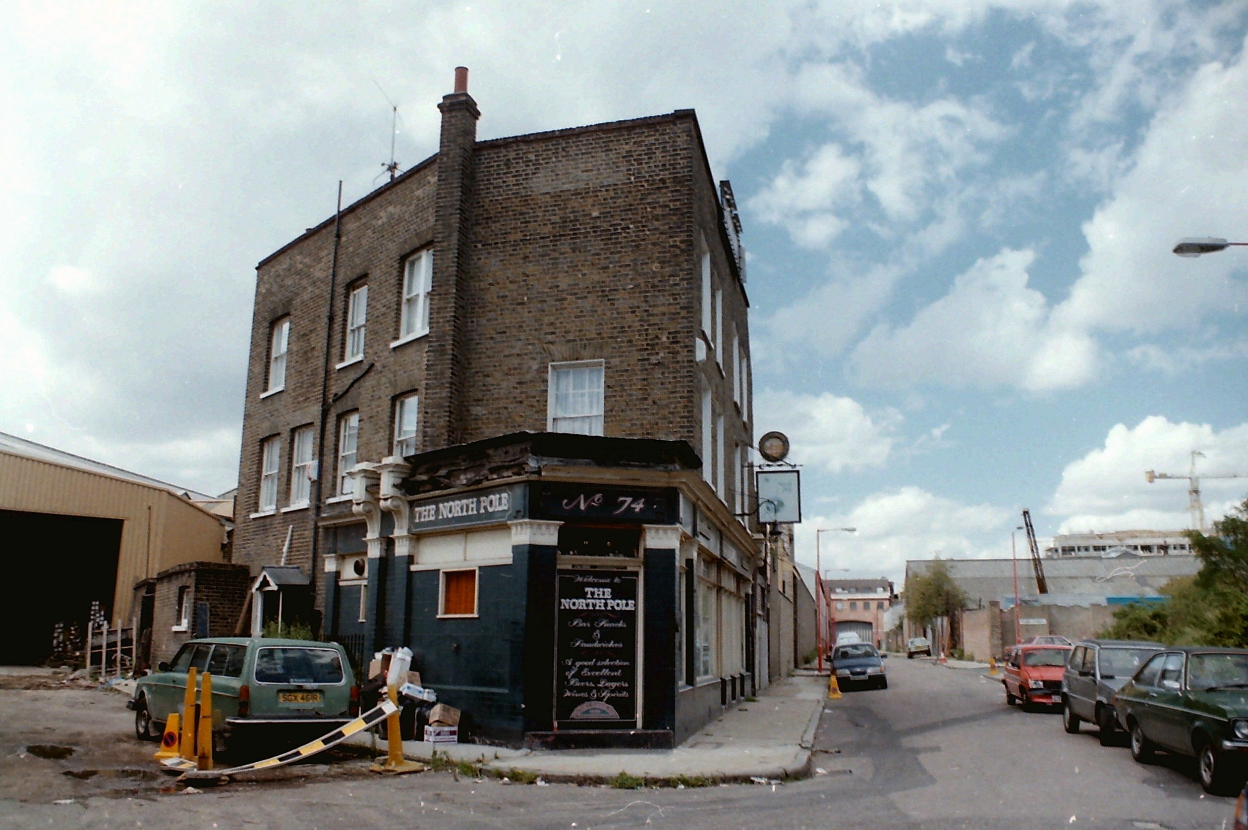
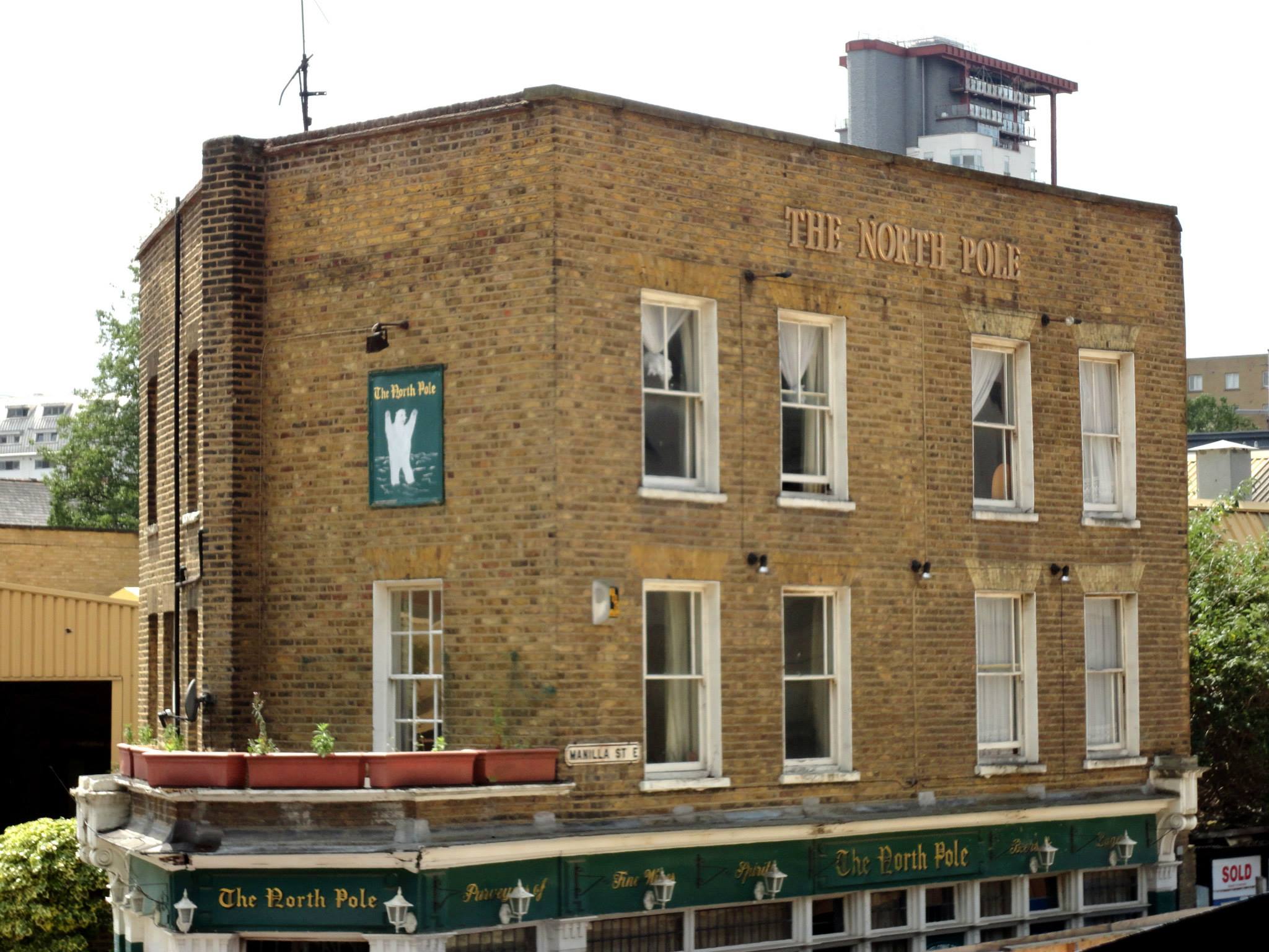
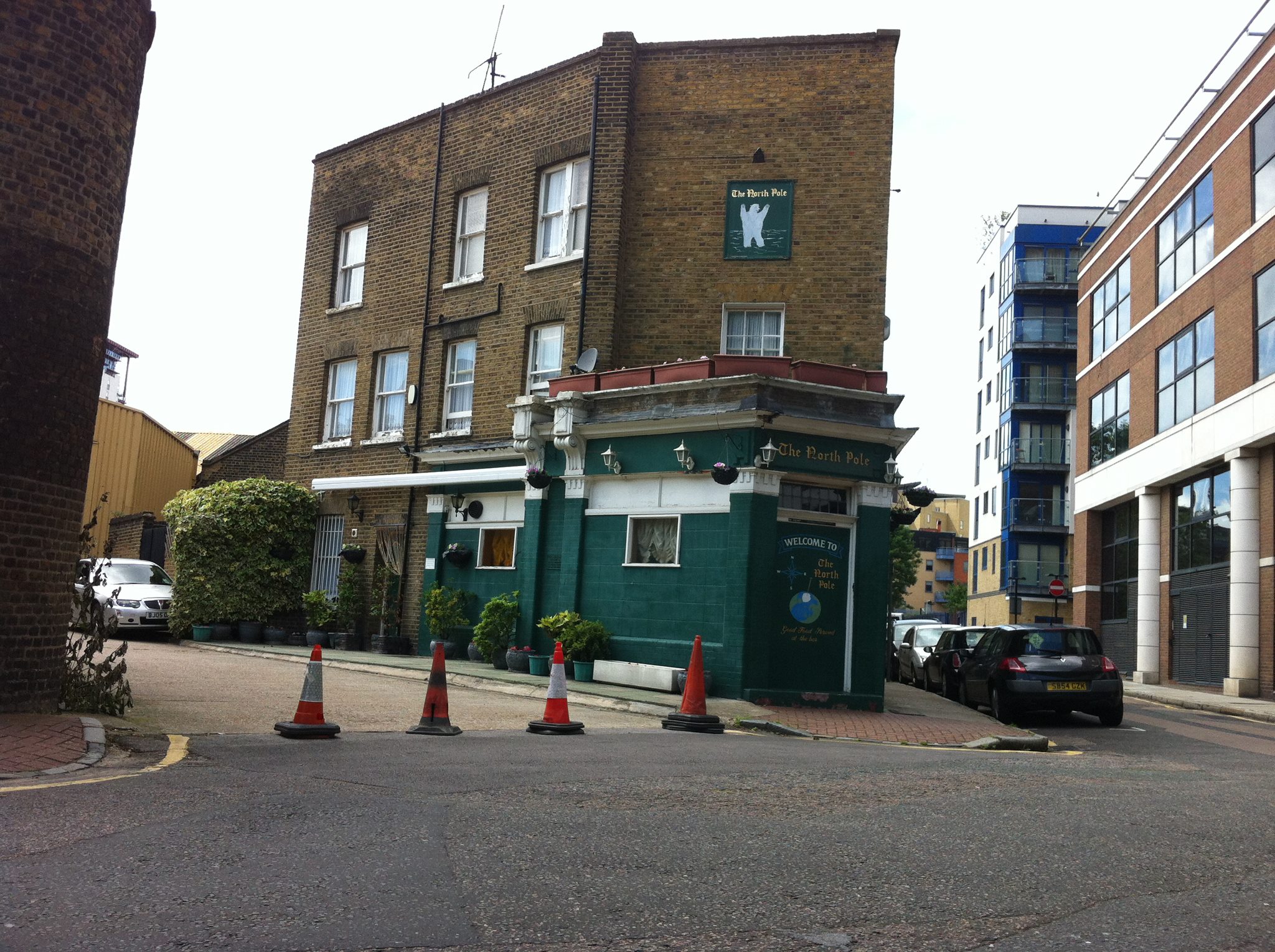
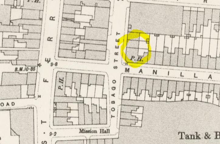
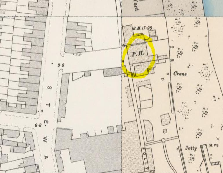
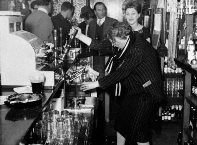
Fishing Smack Public House, Cold Harbour
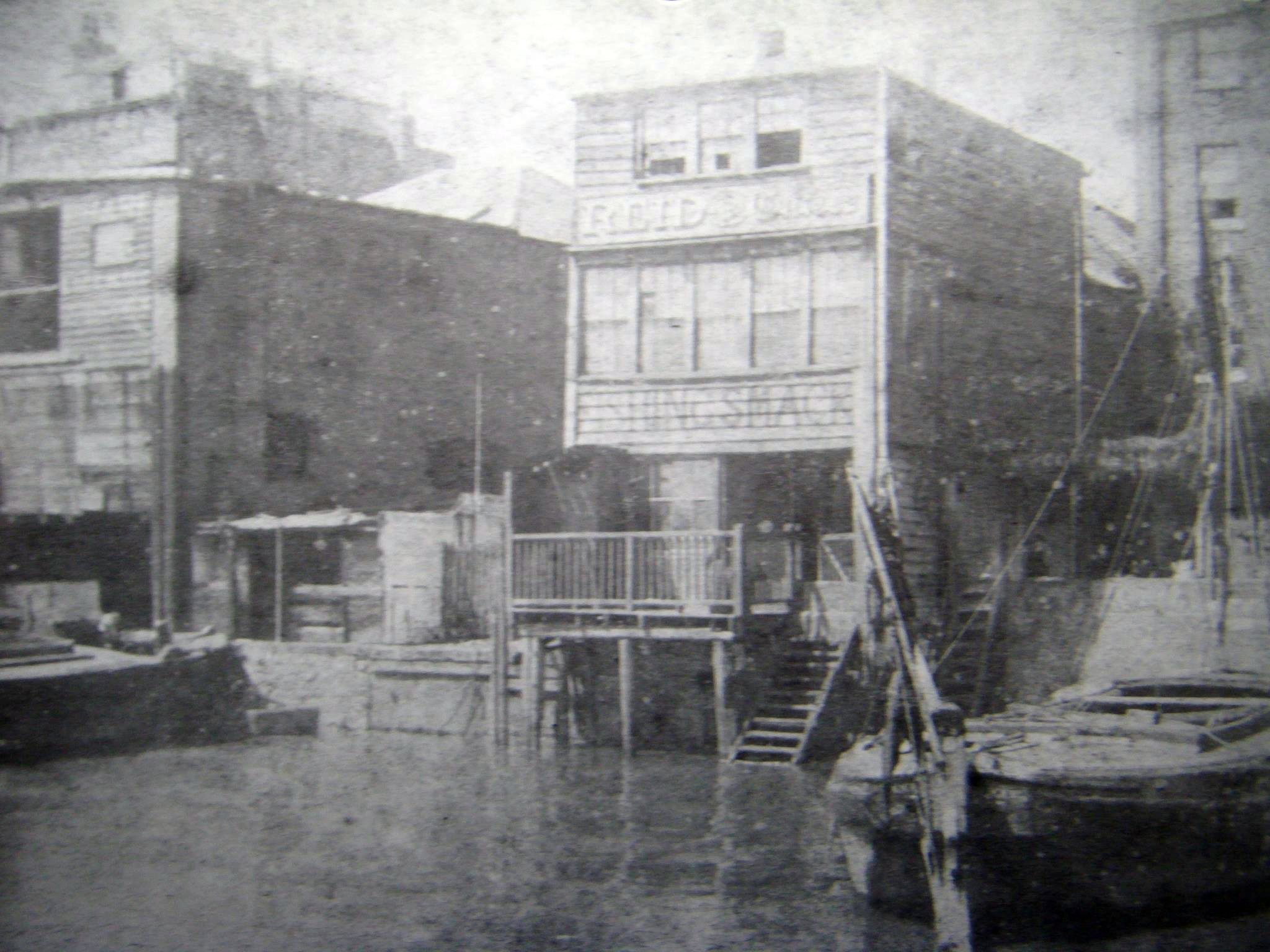
A smack was a traditional fishing boat used off the coast of Britain and the Atlantic coast of America for most of the 19th century and, in small numbers, up to the Second World War. Large numbers smacks operated in fleets from ports in the UK such as Brixham, Grimsby and Lowestoft as well as at locations along the Thames Estuary. In England the sails were white cotton until a proofing coat was applied, usually after the sail was a few years old. This gave the sails its distinctive red ochre colour, which made them a picturesque sight in large numbers.

A smack near Brightlingsea (I do think they are pretty boats).
Galleon House, Glengarnock Avenue

Galleon House (left). Photo: London Metropolitan Archives (City of London)
A galleon was:
…a sailing ship in use (especially by Spain) from the 15th to the 18th centuries, originally as a warship, later for trade. Galleons were typically square-rigged and had three or more decks and masts.

A galleon. Does this look like a block of flats?
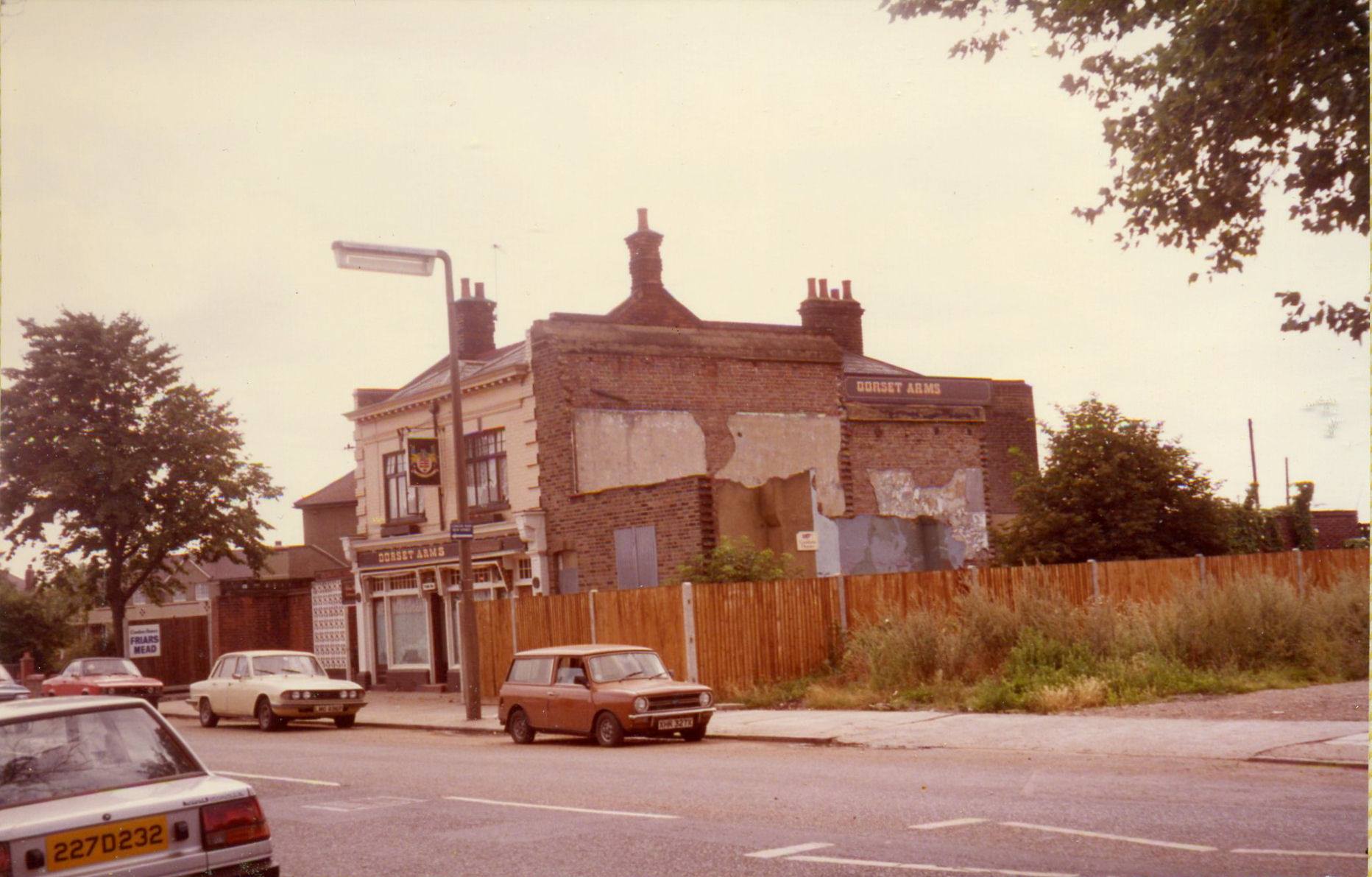
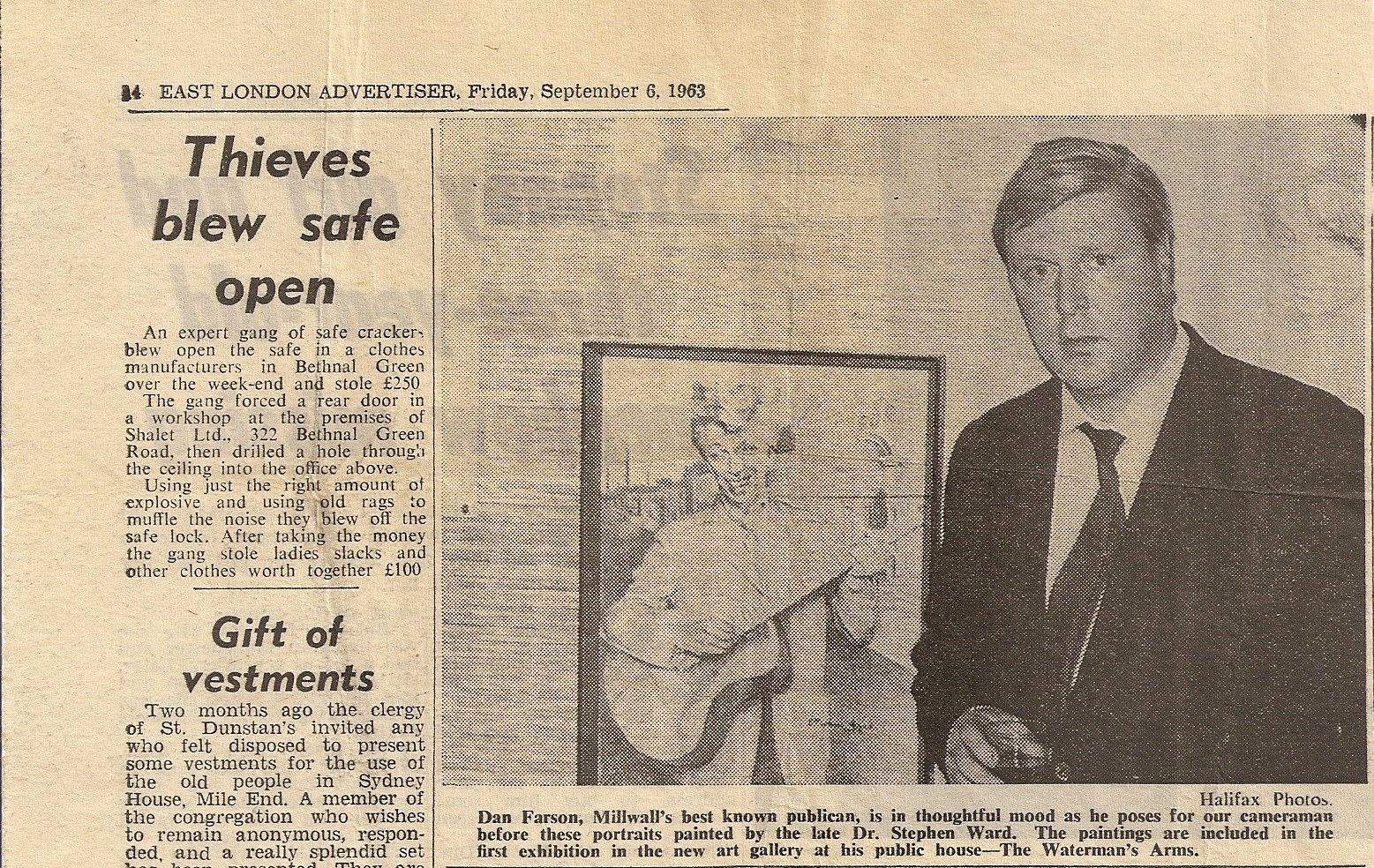
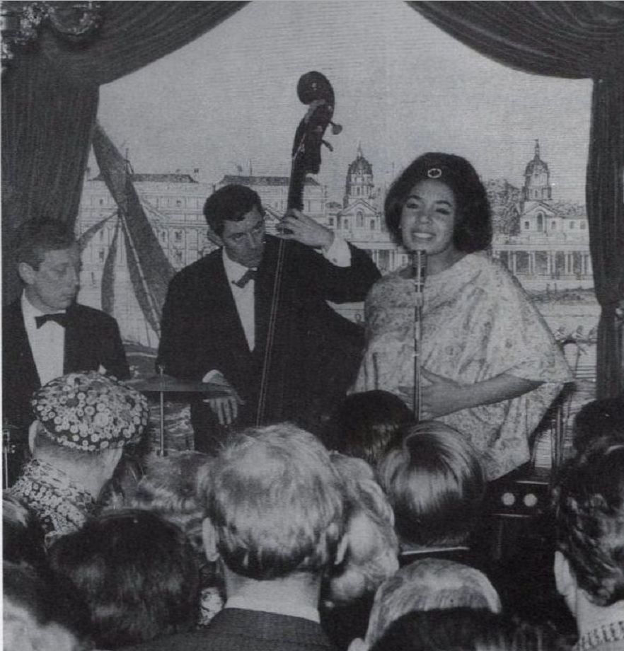
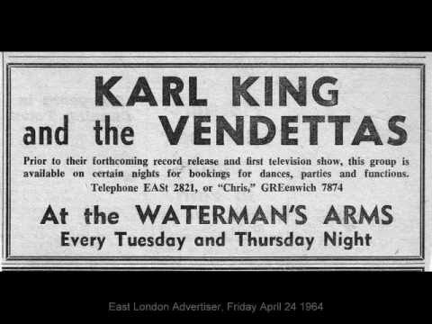
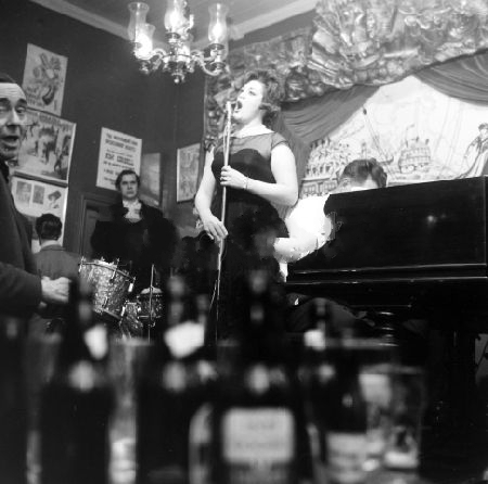
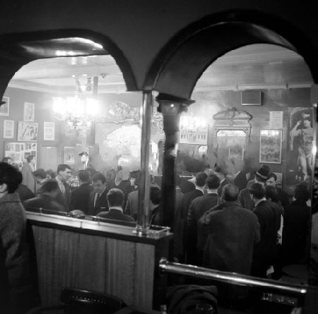
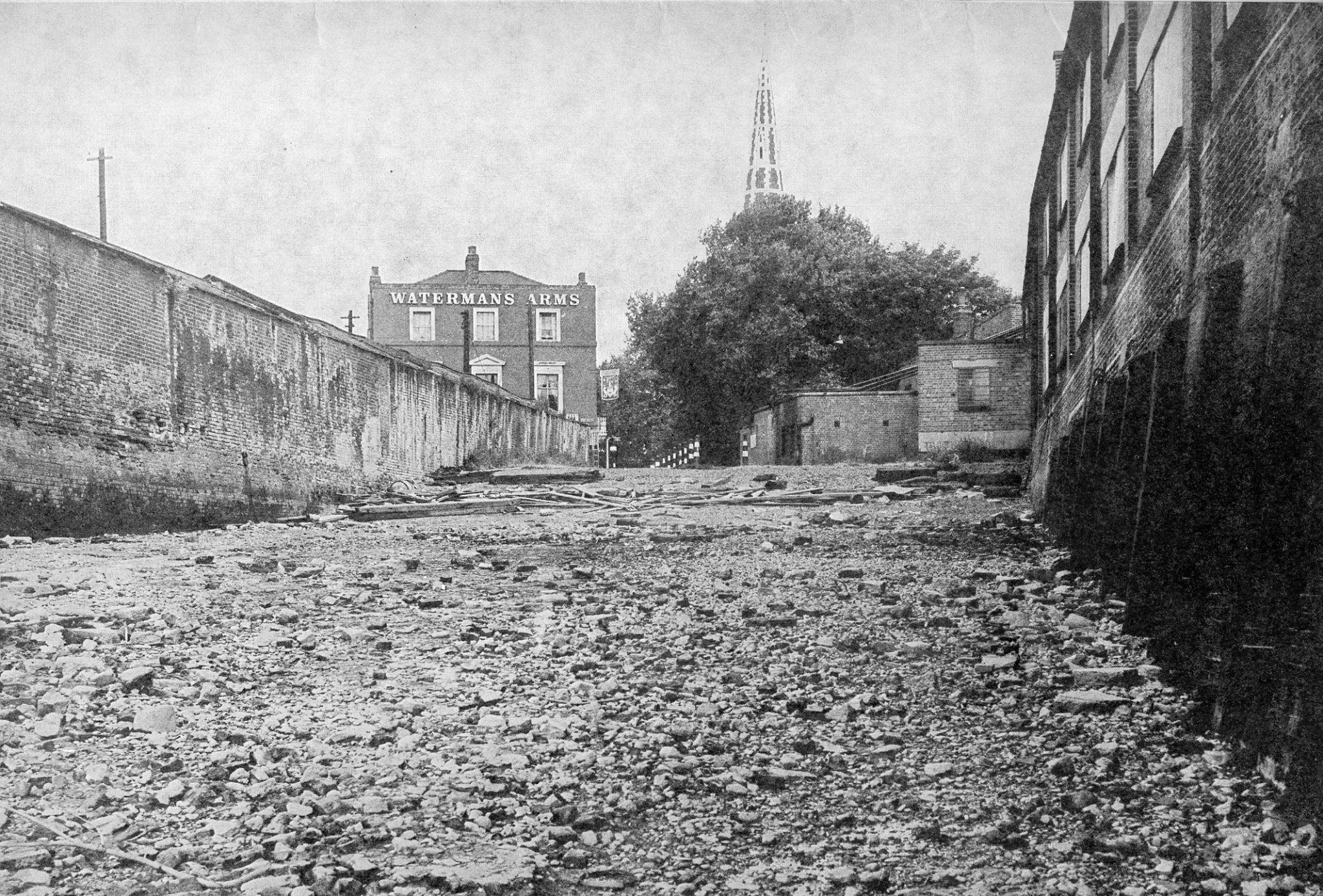
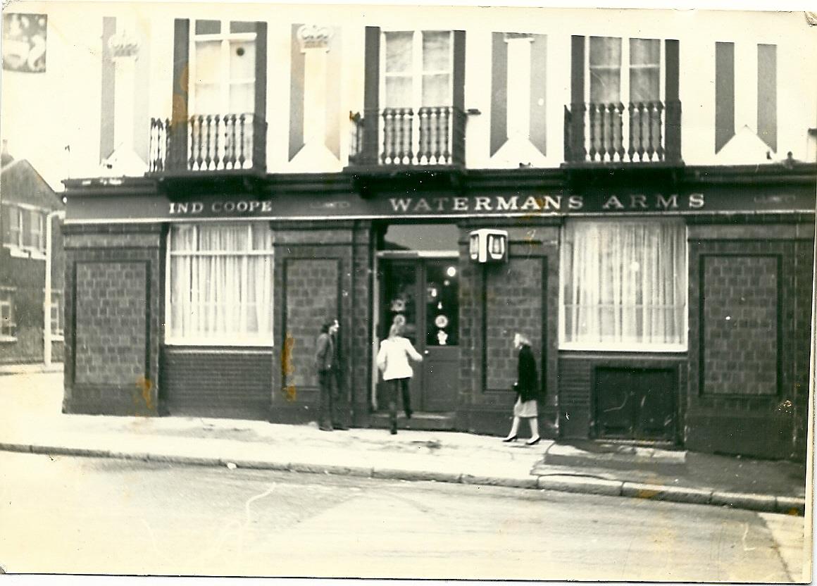
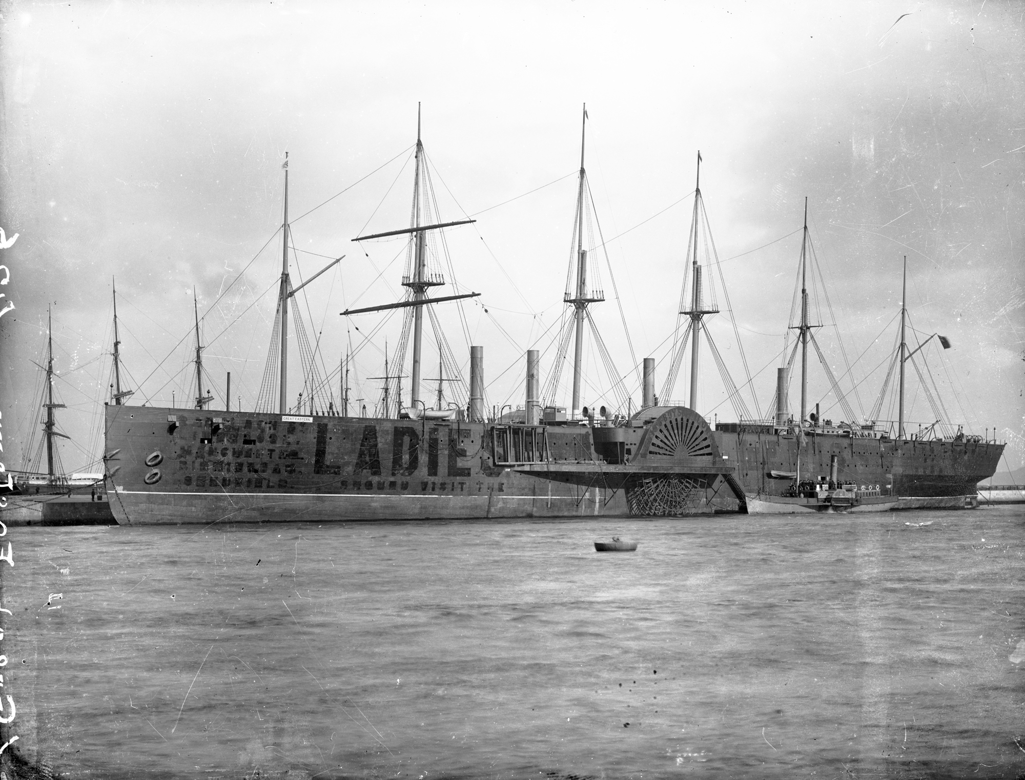
Great Eastern Public House


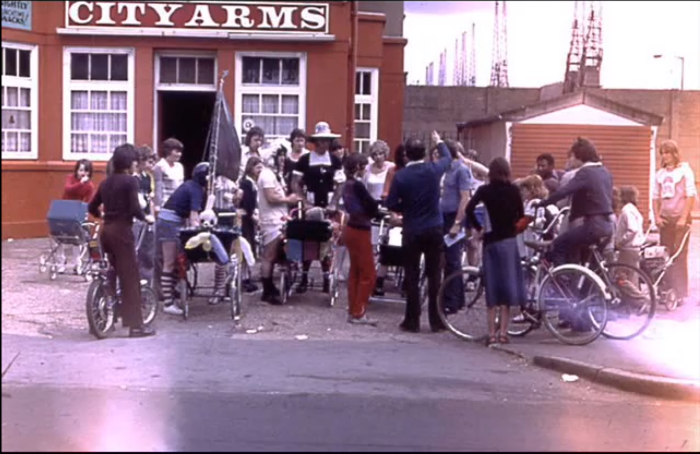
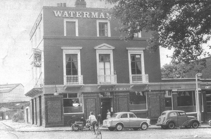
Two Great Easterns for the price of one. The first (actually, the last), in Glenaffric Avenue, and formerly known as the Waterman’s Arms, and – before that – the Newcastle Arms. The second (actually, the the first), on the corner of Westferry Road (foreground) and Harbinger Road (right), and destroyed during the Blitz. The playground of Harbinger Primary School is now on the site.
I discussed the Great Eastern at length in this article.
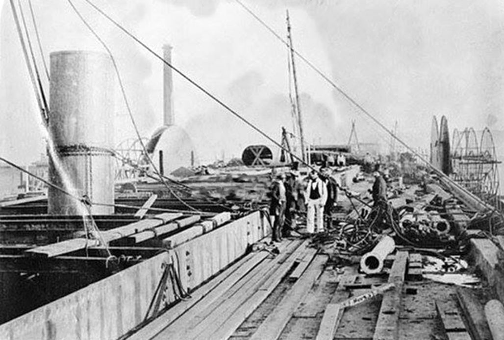

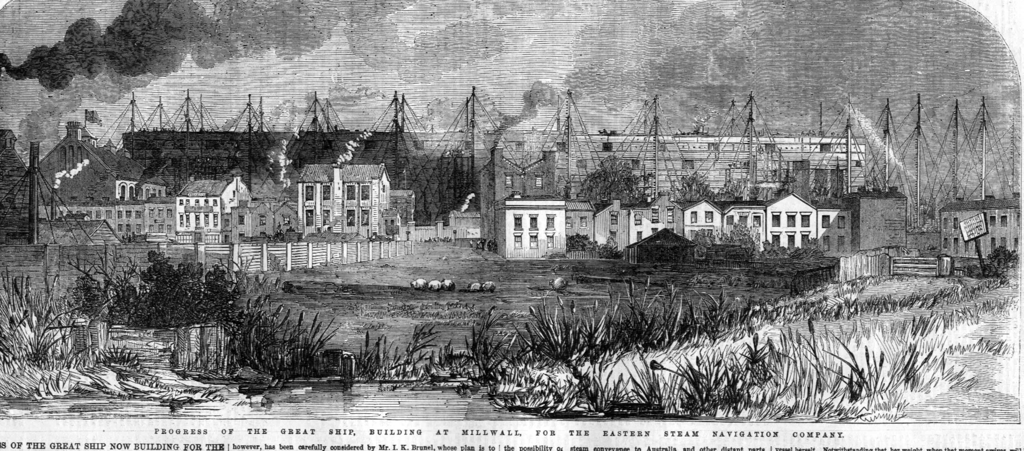

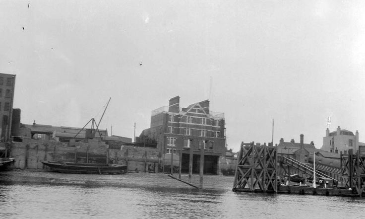
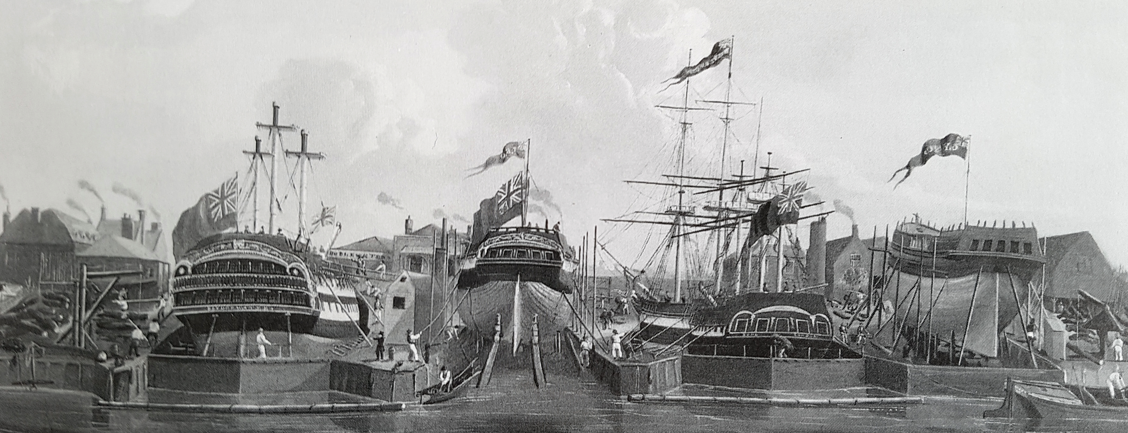
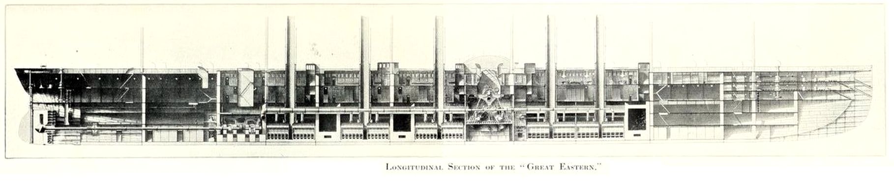
D51533 The ‘Great Eastern’ under construction at Millwall


Halyard House

A halyard is:
…a rope used for raising and lowering a sail, yard, or flag on a sailing ship.
They could have also just called it a rope.
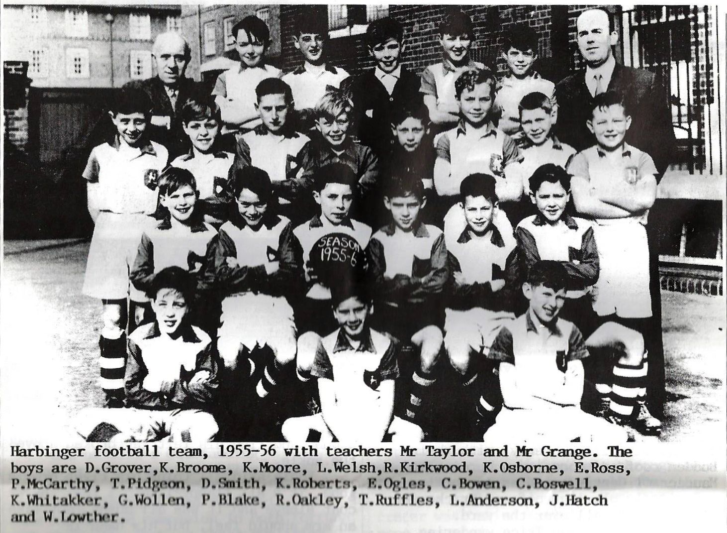
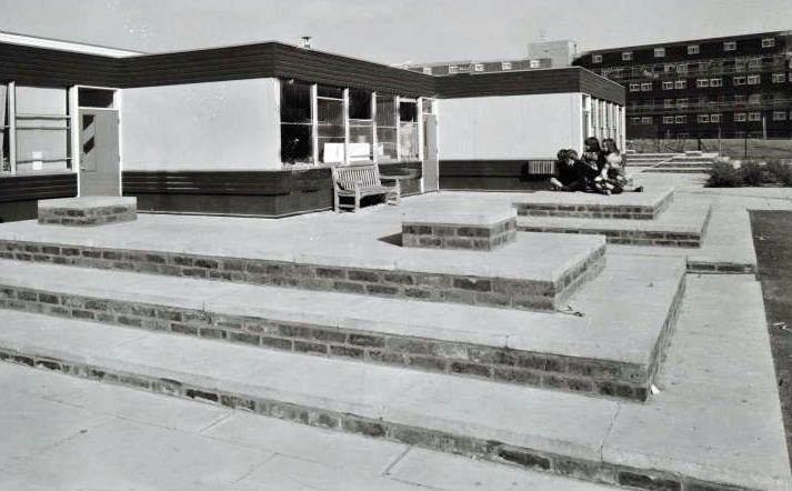
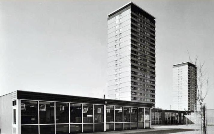
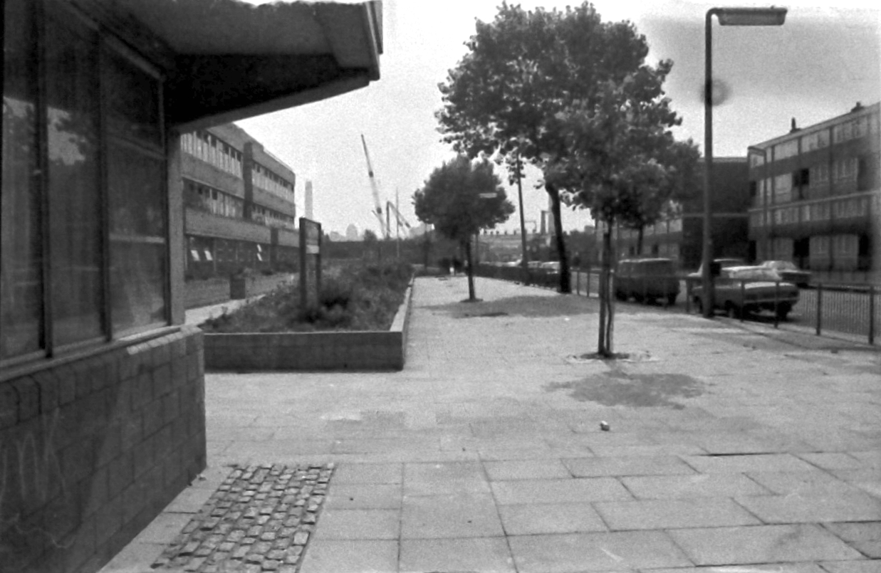
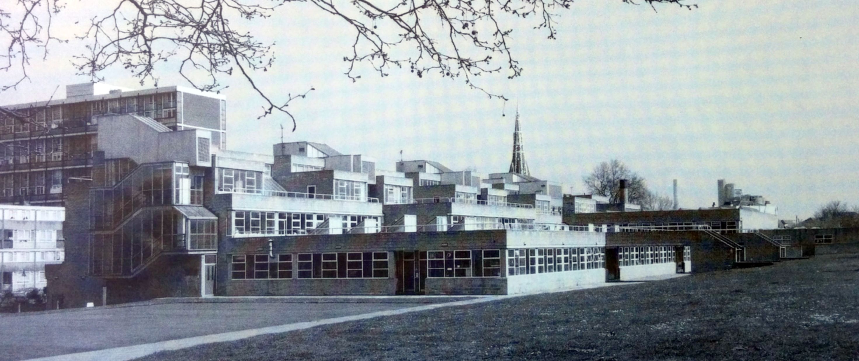
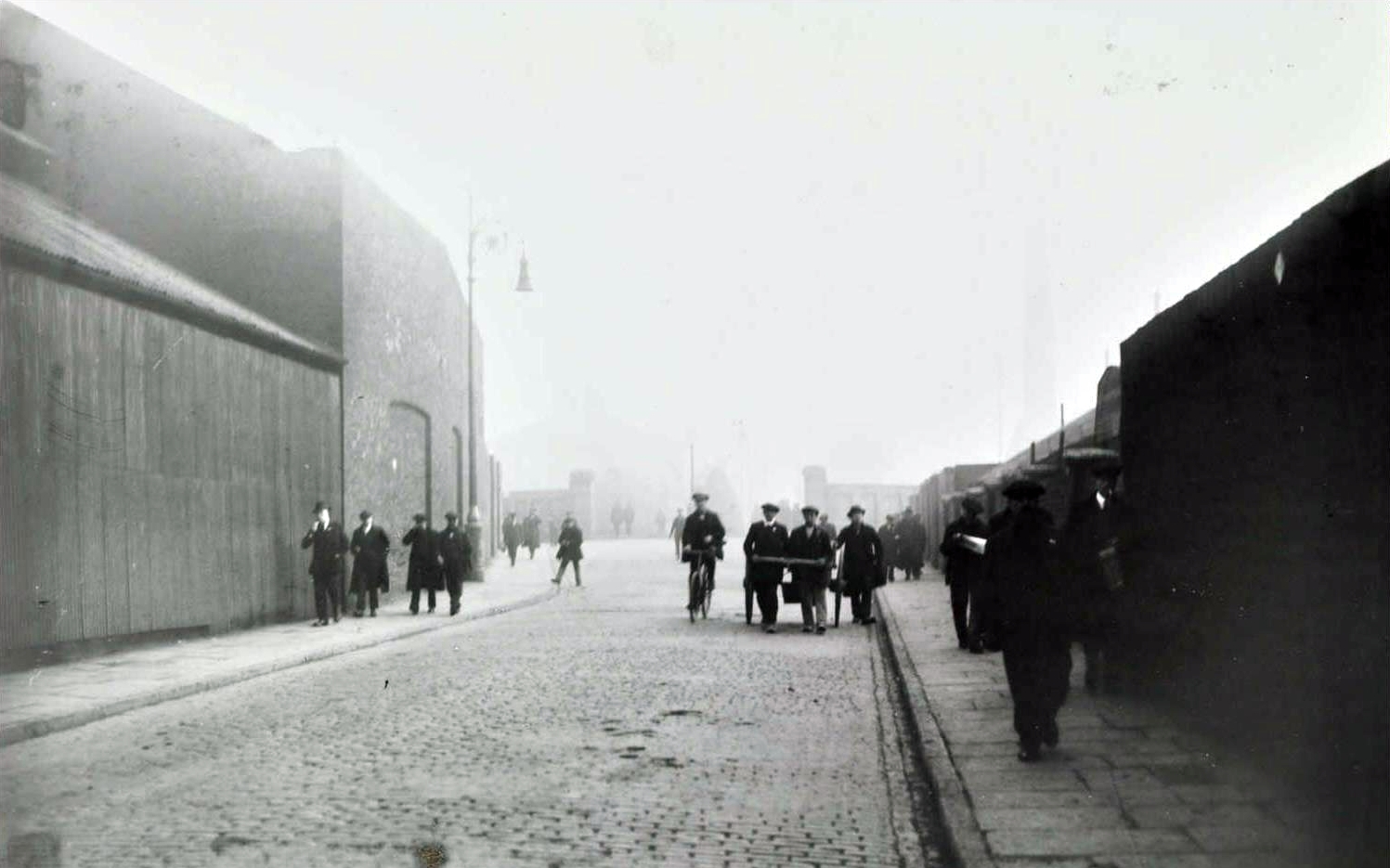
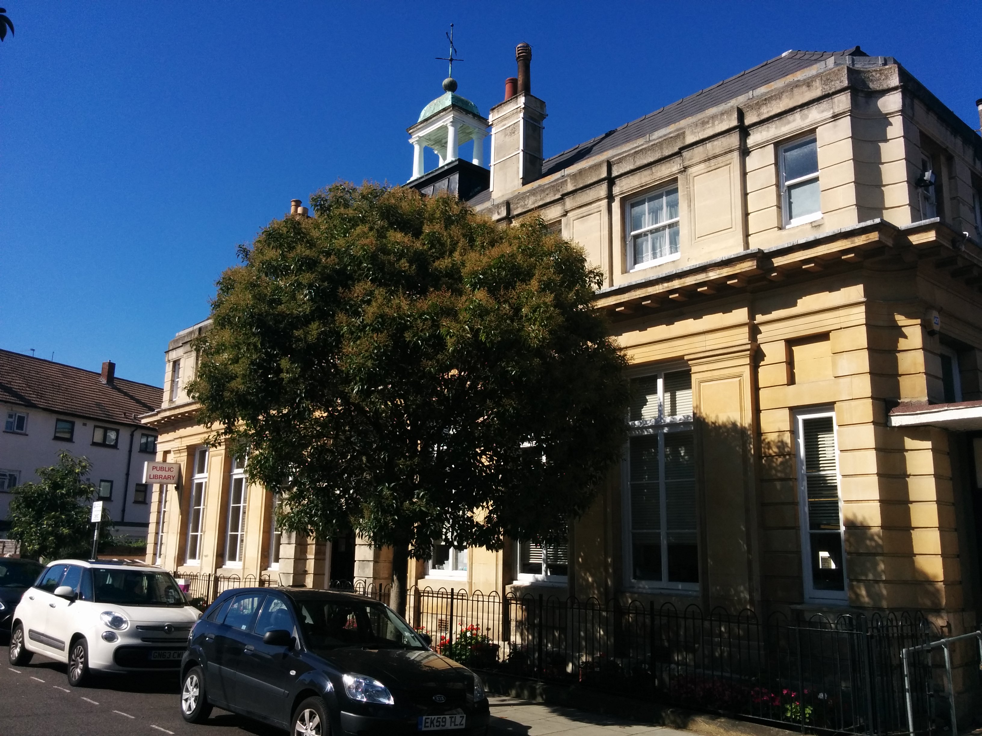
Harbinger School

My school.
The Harbinger was the last sailing ship specially built and fitted for carrying passengers. In more ways than one she was a remarkable vessel, and differed in many interesting details from the stock type of Clyde-built iron clipper. In her rigging and sail plan, she had various fittings which were peculiar to herself.


To begin with, she was the only iron ship which had the old-fashioned channels to spread the rigging: and in another way she went back many years by never bending a sail on her crossjack yard. Instead of this sail she spread a large hoisting spanker, and she always carried a main spencer or storm trysail, a sail very often seen on down east Cape Horners, who found it very useful when trying to make westing off Cape Stiff.
Harbinger was a very lofty ship, measuring 210 feet from the water-line to her main truck, and, unlike the Hesperus, she always carried her skysail yards crossed. Her jibbooms were of unusual length—I say jibbooms, for outside her ordinary jibboom she carried a sliding gunter or flying jibboom. On these she set a whole fleet of jibs, and, as if they were not sufficient, she had cliphooks for a storm staysail on the fore stay.
I have no idea what that was all about, but I am well impressed with the concept of a ‘hoisting spanker’.
Hesperus Crescent
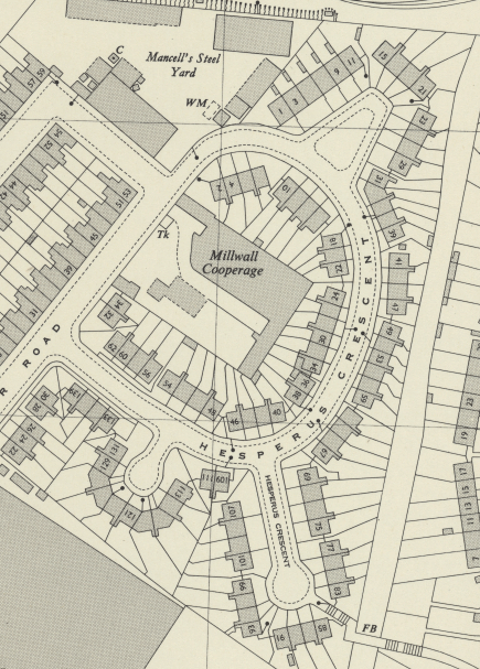
In 1873-4 Robert Steele & Co., the celebrated builders and designers of some of the fastest and most beautiful tea clippers, built two magnificent iron clippers for the Orient Line. These were the Hesperus and Aurora, sister ships. In 1890, the Hesperus was bought by Devitt & Moore for Lord Brassey’s training scheme.

Kedge House, Tiller Road

A kedge is a an anchor, much like the traditional form we would draw if asked to draw a picture of an anchor.

A kedge anchor
Kelson House

A kelson or keelson is:
…the member which, particularly in a wooden vessel, lies parallel with its keel but above the transverse members such as timbers, in order to provide the framework more stiffness.

Ke(e)lson
Killoran House, Galbraith Street

S.S. Killoran was built by the Alilsa Shipbuilding Company of Troon and was launched in 1900.
On August 10th, 1940, the barque Killoran was sunk by the German auxiliary cruiser Widder under command of Korvetten-Kapitän von Rückteschell. It has been reported that the commandant of the Widder was reluctant to sink Killoran, and that it was the ship surgeon who pressed him into doing it.
The surgeon had been filming the voyage, and needed the sinking to have a good ending to the film, and threatened to report the commandant to Berlin if it was not done. The true seamen on board the Widder regarded the sinking as a murder.
Killoran was owned at time of her sinking by a finnish shipowner (Gustav Erikson). At the same time (August 1940), Germany delivered troops to Finland to assist their war against Russia. In the movie, it was told that the Killoran was sailing for British orders and must have been sunk for this reason.
- wrecksite.eu

SS Killoran

SS Killoran in Britannia Dry Dock

SS Killoran in Britannia Dry Dock
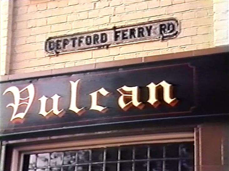
SS Killoran in Britannia Dry Dock, visible behind the houses in Deptford Ferry Road

The sinking of the Killoran, 10th August 1940
Knighthead Point, Barkantine Estate
A knighthead is:
…either of two timbers rising from the keel of a sailing ship and supporting the upper end of the bowsprit.

Launch Street

A launch is an open motorboat. Originally a launch was the largest boat carried by a warship in the age of sail. The word comes from the Spanish lancha (“barge”) and Portuguese, from Malay lancharan (“boat”), from lanchar (“velocity without effort”).
On the River Thames the term “launch” is used to mean any motorised pleasure boat. The usage arises from the legislation governing the management of the Thames and laying down the categories of boats and the tolls for which they were liable.
Lingard House, Marshfield Street

Built in 1893 in Norway, and sold in 1915 to Adelaide company, T. Wardle & Co. who renamed her Wathara. In 1925 she was sold to the Finnish company Gustaf Erikson who restored her name to Lingard. In 1935, on a voyage to Millwall Docks with timber, she collided with the Swedish SS Gerd which was hit in the side and sunk with the loss of the entire crew. The Lingard suffered heavy damages and was towed to Gothenburg, Sweden where she was condemned. After becoming a club house for the Norsk Sejlskute Klubb (Norwegian Sailing Club) and a storage hulk for the Germany army, she was scrapped in 1946 (however, part of the aft deck is taken care of by the Norsk Sjøfartsmuseum, Oslo).


Llandovery House, Chipka Street

After the war, the captain of U-86, LieutenantHelmut Patzig, and two of his lieutenants, Ludwig Dithmar and John Boldt, were arraigned for trial in Germany on war crimes. On July 21, 1921, Dithmar and Boldt were tried and convicted in the case became famous as one of the “Leipzig trials”. Patzig was able to avoid prosecution as he fled the country and avoided extradition; and though Dithmar and Boldt were convicted and sentenced to four years in prison, they both escaped. At the Court of Appeal, both lieutenants were acquitted on the grounds that the captain was solely responsible.


The sinking of the Llandovery Castle
Macquarie Way

Photo: Island History Trust
Sydney Morning Herald, 1953:
Last Days Of The Old Clipper Ship Macquarie By A SPECIAL CORRESPONDENT
“FOR sale by tender. Floating mechanical coaling plant Fortuna . . .as she lies.”
This advertisement, which appeared recently in the “Herald,” marked the last chapter in the story of one of the most celebrated of the old wool and passenger clippers. The Sydney Harbour coal hulk Fortuna, in thc days of her prime when she was called the Macquarie, was a great name on the England-Australia route.
Her story began on a June morning in 1875, when the firm of R. and H. Green, of Blackwall on the Thames, launched an iron ship for their own use. Into it they had put the finest materials, including plates originally stockpiled for a South American man-of-war. The new ship bore upon her bow and stern the name “Melbourne,” after the port with which she was to carry on most of her trade.
Her dimensions proclaim her to have been a really big ship as wind-ships went – 1,852- tons’ register, 269. feet long, and 40 feet in beam. In comfort she was a great advance on her predecessors. Her cabins and saloon, panelled in cedar, were larger, better lit, better furnished and more adequately ventilated than was the general custom of those days.
She carried a surgeon, and with her one-time consort “Sobraon ” later H.M.A.S. “Tingira.” was known, as a “hospital ship because the men of Harley Street and Macquarie Street so
often prescribed tor their patients a sea voyage in one of these comfortable vessels.Until 1887 “Melbourne” traded to thc Victorian capital. In thal year Greens sold her to Devitt and Moore, who placed her in the Sydney trade. On her arrival on December 27, the shipping and shiploving community turned out in force to admire the big iron Blackwaller towing up to Central Wharf, Miller’s Point. They noted her splendid appearance, the long line of painted ports, and the heavily gilded gallery of imitation windows, painted on the stern, indicative of ber direct descent from the East lndiamen of seventy years and more earlier. Most of those frigate-built ships were of teak construction, and three only were fashioned in Iron.
“Melbourne” was the third’ and last. In 1888 her name was changed to “Macquarie.” She was undoubtedly best known in Australia under this name.
A new period in her career opened in 1897, when she became one of Lord Brassey’s cadet ships, still under the ownership of Devitt and Moore, providing, ocean training under sail for the future officers of the British Merchant Service. Her fittings were of the best for this- purpose, and a special schoolroom was constructed in the ‘tween decks for instruction in matters of theory – over 200 midshipmen and cadets. passing through her in her six years as a schoolship.
In these latter years sail owners were resigned to thc encroachment of steam. Nevertheless Devitts kept “Macquarie” and her consort “Illawarra” In service as long as possible. They disposed of the former in 1904 “to Norwegian interests. She had cost £46,750 to build, but her new owners got her for a mere £4,500 – and at the same time changed her name to “Fortuna.” As such she traded to many parts of’the world, making at least two visits to Australia.
But another change was in store for her. In 1909 the Wallarah Coal Co. bought her for a coal hulk in Sydney harbour. Mechanical coaling gear was fitted in 1920, capable of delivering 200 tons of-coal into a steamer’s bunkers per bour, and tho old ship pursued this grimy, but most useful trade, until a few weeks-ago.
So many of her owner’s former clients now fire their ships with oil fuel that the need for a mobile coal hulk is almost negligible, the shore gear at Ball’s Head providing all that is required. Also, the 78-year-old hull would require expensive repairs if she were to continue in service.
Whatever becomes of her In the near future, the picture of this lordly and spotless ship as she was in her great’days, surging along under a press of sail, will Fix this textbe in the minds of all who admire the old ships: . – “For Sale by tender ? . . as she lies.” the old Fortuna has been bought, and it is understood that her new owner will have her broken up. So passes the last of the Blackwall’ Frigates, and the very last deep sea sailing ship built upon the Thames.

Macquarie
Michigan House, Westferry Road

The SS Michigan was built by Harland & Wolff, Belfast in 1891 as a cargo ship with limited passenger accommodation.The Michigan was sold to the U.S. government in 1898 for service as a military transport during the Spanish-American War. In 1899 she was renamed Kilpatrick and was allocated to the Atlantic fleet. In August 1909 she participated in war games off the coast of Massachusetts, pretending to be “a modern battleship of the all-big-gun type” stationed to protect the landing of troops intent on ‘capturing’ New Bedford.
In 1920 the USAT Kilpatrick was sold to the American Black Sea Line, renamed Acropolis, rebuilt to 5,083 tons (including the weight of a dummy funnel), and fitted out with accommodation for 250-cabin and 600-third class passengers. She sailed as an emigrant ship between New York, Piraeus, and Constantinople between April 1921 and September 1922. She was sold in 1923 to the American owned Booras Steamship Company and renamed Washington. She commenced the first of two voyages for her new owners on May 1, 1923, leaving New York for Piraeus and Constantinople, and the second and last on July 7, 1923, when she sailed from New York via Boston. Later the same year she was sold to T. C. Phelps, of New York, who renamed her Great Canton and scrapped her the following year in Italy.


Midship Point

The midship is:
…the portion of a ship between the bow and the stern.
Montcalm House

The Montcalm was built for the African Steamship Company and managed by the Elder, Dempster Line. She carred accommodation for 12-second class passengers and was fitted to carry cattle eastbound and emigrants westbound. The Montcalm sailed on her maiden voyage from Avonmouth to Montreal and was chartered by the Atlantic Transport Line in November 1898. She commenced direct London to New York services on December 24 of that year. In 1898 her shade deck was enclosed and in 1899 she was rebuilt to 6,981 gross tons. January 27, 1900 saw her sail on her last London to New York voyage. On April 5, 1900, she sailed for Capetown as a Boer War transport and completed six New Orleans to Capetown voyages.
June 1902 saw her sail on the first of four Avonmouth to Montreal voyages and in 1903 she was sold to the Canadian Pacific Line. In August 1914 was requisitioned by the British Admiralty and was used as a transport with the British Expeditionary Force until October when she was converted into a dummy of the battleship HMS Audacious. As such, she was one of several decoy ships based at Scapa Flow while the real vessels were at sea. When this fleet of decoys was disbanded in 1915 she became a naval store ship.
She was purchased by the British Admiralty in January 1916 and operated by the Leyland Line. She was converted to a tanker that October and transferred to the Anglo-Saxon Petroleum Company (Shell) as the Crenella. She was torpedoed by U 101 off Ireland on November 26, 1917, but managed to reach port.
After the war she was purchased by the Anglo-Saxon Petroleum Company, and in 1920 was to Runciman’s Velefa Shipping Company of London. In 1923 she was sold to Christian Nielson & Co., and became a Norwegian whaling depot ship renamed Rey Alfonso. By 1925 she was owned by H. M. Wrangell & Co., of Haugesund and in 1927 was sold to the Anglo-Norse Co., of Tronsberg and renamed Anglo-Norse. She was sold yet again in 1929 to the Falkland Whaling Company and renamed Polar Chief.
Laid up for the 1930 season, in 1941 ownership transferred to the Ministry of War for service as a transport, and she was renamed Empire Chief. She survived the war and was returned to the South Georgia Company in 1946 under her previous name, Polar Chief. She was finally scrapped at Dalmuir in Scotland in 1953.

Montfort House, Galbraith Street

The “Montfort” was built in 1899 by Palmers Co Ltd, Jarrow-on-Tyne for Elder
Dempster’s Beaver Line. She was a 5,519 gross ton ship, length 445ft x beam
52.2ft, one funnel, four masts, twin screw and a speed of 13 knots. Built
primarily as a cargo vessel, she had accommodation for only 12-1st class
passengers.
Launched on 13/2/1899, she sailed from the Tyne on her maiden voyage to
Quebec and Montreal on 26/4/1899. In May 1899 she made her first of four
Avonmouth – Montreal passages. She was transferred to trooping duties for
the Boer War and commenced her first of three Liverpool – Capetown voyages
on 11/11/1899. She also made one round voyage from each of Halifax, New
Orleans and Fiume to Capetown.
In 1900 she was refitted to carry 30-1st class and 1,200-3rd class
passengers and her tonnage increased to 7,087 tons. Her first passenger
voyage between Liverpool, Quebec and Montreal commenced on 17/7/1900 and she
received several refits to various tonnages between 1901-1903. In 1903, the
“Montfort” went to Canadian Pacific together with the rest of Beaver Line’s
Canadian fleet and her accommodation was altered to carry 30-2nd and
1,200-3rd class passengers. The following year the company switched it’s
service from Avonmouth to London/Antwerp to Canada and on the eastbound
journey, the third class berths were frequently dismantled in Montreal and
replaced with portable stalls to carry upwards of 1,200 head of cattle to
London.
In 1909, she was again rebuilt to 6,578 tons and on 6/12/1916 was torpedoed
and sunk by the German submarine U.55, 170 miles from Bishops Rock, Scilly
Islands, with the loss of 5 lives.

Montrose House

The SS Montrose was built by the Fairfield Shipbuilding and Engineering Company in Glasgow, Scotland, as the passenger ship SS Montrose for the Canadian Pacific Steamships Company and was launched on 14 December 1920, sponsored by Lady Raeburn, the wife of the Director-General of the British Ministry of Shipping.
Montrose ran aground on 7 August 1925 in the Saint Lawrence River in Canada.[1] She was refloated on 10 August 1925 and drydocked for repairs to her rudder and port propeller.
On 31 July 1928, Montrose collided with the British cargo ship Rose Castle in the Saint Lawrence River, Quebec, Canada; Rose Castle beached herself to avoid sinking but was refloated on 3 August 1928.
On 4 September 1939, Montrose was requisitioned by the British Admiralty for World War II service with the Royal Navy and converted to an armed merchant cruiser. Her conversion was completed on 6 November 1939 and she was commissioned into Royal Navy service as HMS Forfar (F30).


Pinnace House, Samuda Estate

A pinnace is:
…a light boat which was carried aboard larger boats or ships, mainly used as a tender.

A pinnace aboard a sailing ship
Quarterdeck
A quarterdeck is:
…a raised deck behind the main mast of a sailing ship. Traditionally it was where the captain commanded his vessel and where the ship’s colours were kept. This led to it being used as the main ceremonial and reception area on board, and the word is still used to refer to such an area on a ship of even in naval establishments on land.

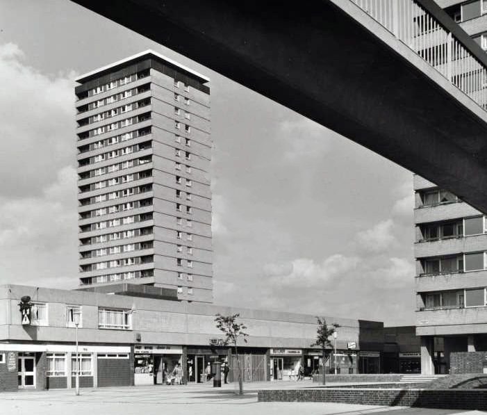
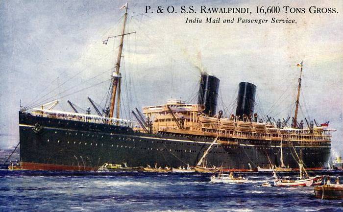
Rawalpindi House

HMS Rawalpindi was a British armed merchant cruiser, (a converted passenger ship intended to raid and sink enemy merchant shipping) that was sunk in a surface action against the German battleships Scharnhorstand and Gneisenau during the first months of the Second World War.
Rawalpindi was requisitioned by the Admiralty on 26 August 1939 and converted into an armed merchant cruiser by the addition of eight elderly 6 in (150 mm) guns and two 3 in (76 mm) guns. She was set to work from October 1939 in the Northern Patrol covering the area around Iceland. On 19 October in the Denmark Strait, Rawalpindi intercepted the German tanker Gonzenheim (4,574 grt), which had left Buenos Aires on 14 September. The tanker was scuttled by her crew before a boarding party could get on board.
Whilst patrolling north of the Faroe Islands on 23 November 1939, she investigated a possible enemy sighting, only to find that she had encountered two of the most powerful German warships, the battle cruisers Scharnhorst and Gneisenau, which had been conducting a sweep between Iceland and the Faroes. Rawalpindi was able to signal the German ships’ location back to base. Despite being hopelessly outgunned, 60-year-old Captain Edward Coverley Kennedy RN of Rawalpindi decided to fight, rather than surrender as demanded by the Germans. He was heard to say “We’ll fight them both, they’ll sink us, and that will be that. Good-bye”.
The German warships sank Rawalpindi within 40 minutes. She managed to score one hit on Scharnhorst, which caused minor splinter damage. 238 men died on Rawalpindi, including Captain Kennedy. Thirty-seven men were rescued by the German ships, a further 11 were picked up by HMS Chitral (another converted passenger ship). Captain Kennedy — the father of naval officer, broadcaster and author Ludovic Kennedy — was posthumously Mentioned in Dispatches.

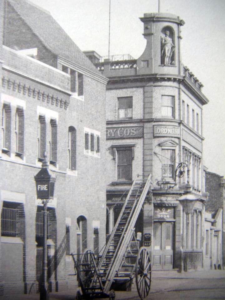
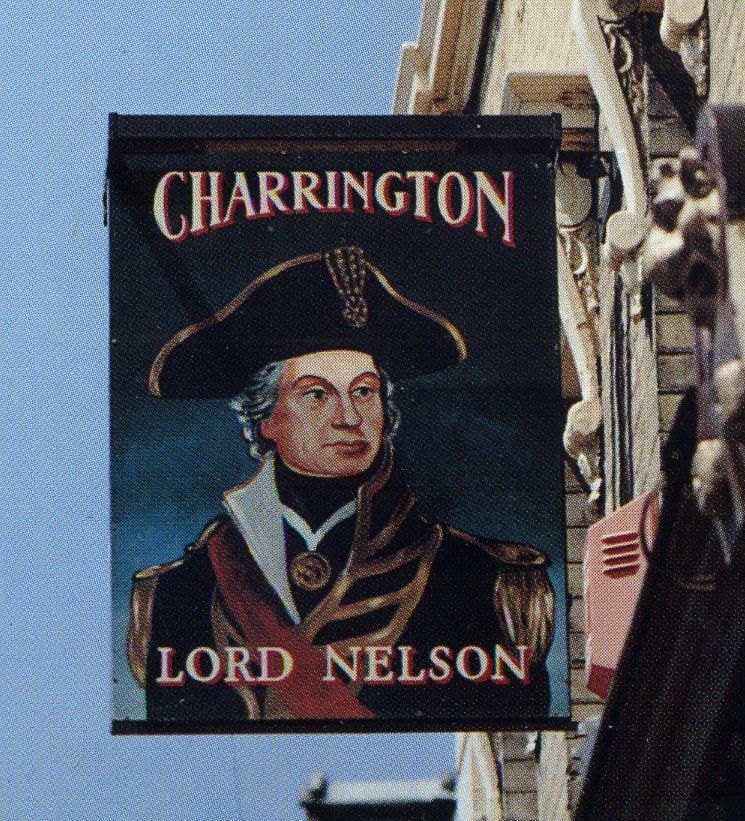
Rodney House

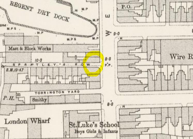
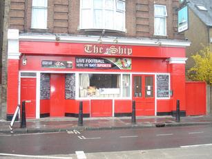
Schooner Street/House/Close

Ship Street, briefly named Schooner Street before George Green’s School was built on its site.
A schooner is:
… a type of sailing vessel with fore-and-aft sails on two or more masts, the foremast being shorter than the main and no taller than the mizzen if there is one. While the schooner was originally gaff-rigged, modern schooners typically carry a Bermuda rig.

Schooner
Spinnaker House, Byng Street

A spinnaker is:
… a sail designed specifically for sailing off the wind from a reaching course to a downwind, i.e. with the wind 90°–180° off bow. The spinnaker fills with wind and balloons out in front of the boat when it is deployed, called flying. It is constructed of lightweight fabric, usually nylon, and is often brightly coloured. It may be optimised for a particular range of wind angles, as either a reaching or a running spinnaker, by the shaping of the panels and seams. Some types of spinnaker can be carried by the side of the boat, but still in front of the mast. This is called “flying a shy spinnaker”, and is used for reaching.

Spinnaker
Tamar House, Plevna Street

HMS Tamar was a Royal Navy troopship built by the Samuda Brothers, and launched in Britain in 1863. She served as a supply ship from 1897 to 1941, and gave her name to the shore station HMS Tamar in Hong Kong (1897 to 1997).
The 1863 incarnation of HMS Tamar was the fourth to bear that name, which is derived from the River Tamar, in Cornwall, and the ship’s crest is based on its coat of arms.
Tamar was dual-powered with masts and a steam engine, giving a speed of 12 knots. She originally had two funnels, but she was re-equipped with a more advanced boiler and reduced to one funnel.
In 1874, she formed part of the Naval Brigade that helped to defeat the Ashanti in West Africa, during the Ashanti War. Tamar took part in the bombardment of Alexandria in 1882.
In 1897 Tamar was hulked as a base ship and relieved HMS Victor Emmanuel as the Hong Kong receiving ship. She was used as a base ship until replaced by the shore station, which was named HMS Tamar, after the ship.
The Tamar had been towed out to a buoy on 8 December during the Battle of Hong Kong during World War II. Amidst a curfew of darkness and bombardment by the Japanese forces, the orders came at 2100 hours on 11 December to scuttle her. She was scuttled at the buoy on 12 December 1941 once it was clear that the advance could not be arrested, to avoid being used by the invading Japanese Imperial forces. As the ship’s superstructure became airlocked, the ship refused to sink for some time, until the Royal Artillery was called in to administer the coup de grâce.
A mast from this ship is now erected outside Murray House in Stanley, Hong Kong.
In late 2014, during dredging work for the Central–Wan Chai Bypass, the remains of what strongly appears to be HMS Tamar were discovered at the location where she is believed to have been scuttled.

HMS Tamar in Malta
Thermopylae Gate

Thermopylae was built for the Aberdeen Line, which was founded in 1825 by George Thompson. Thermopylae was designed for the China tea trade, and set speed records on her maiden voyage to Melbourne—63 days, still the fastest trip under sail.
In 1872, Thermopylae raced the clipper Cutty Sark from Shanghai back to London. Thermopylae won by seven days after Cutty Sark lost her rudder. From 1882 onward, Thermopylae took part in the Australian wool trade; however, on this route Cutty Sark proved faster.
In 1897 she was sold to Portugal for use as a naval training ship and renamed Pedro Nunes. On 13 October 1907, the Portuguese Navy towed her down the Tagus river using two warships, and before Amelia de Orleans, Queen of Portugal, she was torpedoed with full naval honours off Cascais.


Topmast Point
Traditional ships’ masts are not single spars but are made of two or even three spars. The mast above the lower mast (aka mizzen, main or fore mast) is known as the topmast.
Topmast, which is not at the top, those pesky maritime people.
Triton House, Cahir Street

Built at Blackwall in 1846, fitted out and commissioned at Chatham a year later.
17 Oct 1854 1st Bombardment of Sebastopol – see p. 437 at http://www.archive.org/details/royalnavyhistory06clow
24 Nov 1857 departed England for anti-slavery duties on the West Coast of Africa.
8 Feb 1858 off Tachin, boarded the Spanish brig Don Juan in accordance with the appropriate Treaty for the suppression of the Slave Trade.
18 Mar 1858 ashore enquiring about slaves for the schooner Hanover, supposed to be lurking in the offing. Remained in search of the human cargo that the Hanover hoped to slip in and embark, in order that the Triton would be ready for her.
4 Feb 1859 when at anchor off Killongo observed a vessel in the offing : following a chase of 4 hours was detained the slave brigantine Name Unknown, supposed George Louhse, and being without flag or papers she was sent for adjudication to the Vice-Admiralty Court at St. Helena and on 7 Mar 1859 sentenced to be condemned. 8 Oct 1860 Prize money due payable.
20 Apr 1859 was in the River Congo when the USS Marion arrived in the River and the the following day seized the American slave barque Orion, with all he crew, which she sent to New York for adjudication, followed a few days later by the American brig Ardennes, who arrived in the River with the Pluto, in which case Commander Brent of the Marion considered that the master had perjured himself to the authorities at Jacksonville by stating that he was sailing for the Canaries, whereas he never went near the islands, nor had any intention of doing so despite having 2 “passengers” on board who had been furnished with passports for those islands, but were most probably more interested in the vessel’s prospective slave cargo ?
4 Jul 1859 detained a slave schooner, Name Unknown, which was sent for adjudication to the Vice-Admiralty Court at St. Helena and sentenced to be condemned.
8 Aug 1859 anchored near Point Padrone, having spoken to the Vesuvius to the south of Snake’s Head, regarding various meetings the Triton had had with the American ship Memphis, which when first visited was supposedly disguised as a whaler, whilst plainly engaged in the slave trade, and that her movements were closely watched from 14 Jul when her movements became most suspicious.
8 Aug 1859 having received information from the ship’s boats that the suspected American slave vessels Ottawa and Lillie Mills had gone up the River Congo to Punta da Lenha, departed in pursuit to anchor in company with them and on 10 Aug went on board the Lillie Mills to inspect her papers. Her master, R. H. Weeks, stated that he was a former RN seaman who had served on board HMS Dido in 1848, who now claimed to be a citizen of the United States.
11 Aug 1859 followed the Ottawa down river, which being so closely watched left the river for the sea and thence to the southward, and was suspected of seeking a slave cargo elsewhere, such as Ambrizette or Moanda.
17 Aug 1859 detained off Bahia Fonda, a few miles to the north of Ambriz after a chase of over 3 hours the slave schooner, Name Unknown, supposed Juana, and without papers or flag, her crew having deserted, which was sent under the command of Mr. Edward C. Smyth, Second Master, for adjudication to the Vice-Admiralty Court at St. Helena and on 15 Sep 1859 sentenced to be condemned.
11 Sep 1859 boarded the American ship (former barque) Emily, which had been acting suspiciously by anchoring the previous evening in Bahia Fonda Bay, only normally used by vessels involved in the slave trade, however her papers being in order she was allowed to go about her business.
13 Oct 1859 boarded the American brig Taverier, of New York, which, whilst her papers appeared to be in order, it being noted that there was no means of proving their authenticity, and raised some points which might suggest that there did appear to be some problems with the papers, but that could only be resolved by a U.S.N. officer, which would appear to have been confirmed by the fact that she was detained by the Viper on the 4 Nov 1859 with 518 negroes on board.
22 Dec 1859 with the Viper, chased a slave brig, Name Unknown, but supposed Dos Hermanos, but lost her.
24 Dec 1859 chased and detained in Lat. 7° 17′ S., long. 12° 14′ E., off Bahia Fonda, a slave brig, Name Unknown, supposed Dos Hermanos, about 200 tons, as she was preparing to embark her human cargo. She was sent to the Vice-Admiralty Court at St. Helena for adjudication in the charge of Master’s Assistant C. J. Bigley and on 23 Jan 1860 sentenced to be condemned.
9-10 Jan 1860 detained in Lat. 5° 8′ S., long. 11° 52′ E., a slave barque Name unknown, supposed Pamphylia, with 6-700 slaves on board, 200 youngsters, for their own safety, being removed to the Triton, both vessels departing for the adjudication to the Vice-Admiralty Court at St. Helena where on the 13 Feb 1860 the Pamphylia was sentenced to be condemned.
13 Apr 1860 detained in Lat. 3° 25′ N., long. 11° 1′ W., a slave ship, Name Unknown, supposed Roanoke, which was sent for adjudication to Sierra Leone and on 25 Apr 1860 sentenced to be condemned.
7 Jan 1861 returned to England from the West Coast of Africa.

Warspite House

Training Ship Warspite was owned by The Marine Society. Originally moored at Woolwich, she was accidently destroyed by fire in 1876. Another ship, HMS Conquerer was obtained from the Royal Navy and it was this ship, renamed Warspite that came to Greenhithe. Her moorings were downstream from Arethusa off from Charles Street. In 1918 by an act of arson by three boys protesting about conditions, she was also destroyed by fire. They’d already had one attempt foiled during the day but suceeded after lights out. In 1922 The Marine Society obtained yet another ship, HMS Hermione, a victorian cruiser and moored her off Greenhithe as Warspite. She lasted about ten years but was moved several times as she was obstructing Everard’s ships and was finally moved to Grays, Essex until she was broken up for the war effort in 1940.